Downloading OpenStreetMap.org project cartography to GARMIN navigators without a memory card slot
Hello, folk wisdom says that avaricious always pays. One of my friends is a miner, and by hobby, a fisherman and a hunter, having retired, decided to join the world of high technologies. All my life I walked in the Siberian taiga using natural navigation, and here I bought, after consulting exclusively with the seller from the store, a miracle device GARMIN ETREX 10. But considering that now all navigators have an additional memory slot, I promised him to load a map better than a white field with the point of Novosibirsk. To my surprise in 2012, GARMIN released the device only with built-in memory and a very modest size. The Kuzbass map from the open project OpenStreetMap.org fit, but the device could not record the track, complained about the lack of space. I decided to download only the part where the owner of the navigator usually hunts and fishes, adding as much height as possible.Polish format in GPSMapEdit and removing everything unnecessary, tried to save it in an IMG file, got a bunch of errors on the number of points on the road, I began to look for another solution.
The next thing I tried was Map Composer, but I couldn’t get to change the interface from German to English. Web searches led to GroundTruth . Requires Microsoft .NET 3.5 or higher and cgpsmapper to work, suitable in the free version. Clear documentation and a few lines in the cmd file:
They issued a ready IMG for loading into the device, but the signatures on the card are not in Cyrillic. For the former miner, this was not good.
The next thing I used was the Java program Mkgmap & Srtm2Osm requiring Microsoft .NET 2.0 or Mono if you have Linux.
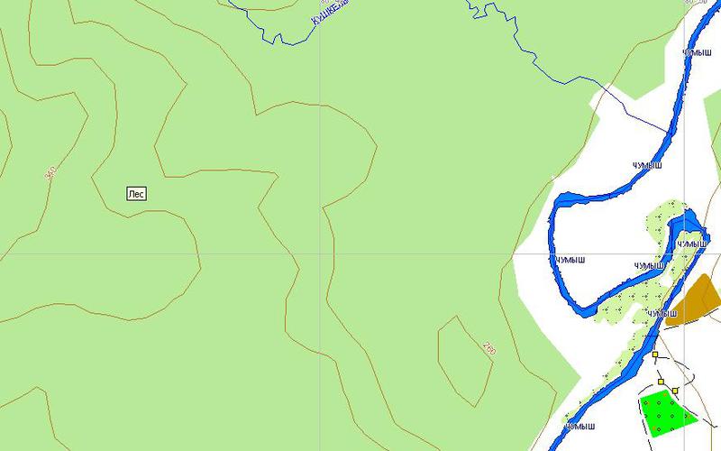
Open the desired area on the openstreetmap.org website and select the "Export" item. We note the OpenStreetMap XML format. If the area is too large, the Export button will be inactive. If you try to download a relatively large settlement, most likely you will get “You requested too many nodes (limit is 50000). Either request a smaller area, or use planet.osm . " Zoom in and download several osm files by moving the visible area.
From several files, select gmapsupp.img and copy it to the device. Depending on the device, you may need to replace the base card by renaming our file to gmapbmap.img.
For pedestrian navigation it is convenient to have high-altitude data on the map. Radar topographic surveys of most of the globe (SRTM) are available for free in several ways. The Srtm2Osm program allows you to obtain this data in the area we need in several ways.
Pointing the square from the coordinates -bounds1 53.49 87.05 53.99 87.55
Pointing the point and radius in km from it -bounds2 53.69 87.05 10
Or a link to openstreetmap.org -bounds3 " www.openstreetmap.org/?lat=53.69&lon=87.059&zoom=10&layers=M "
We copy the resulting osm file to our osm files and repeat the map assembly described above.
I hope my first article on Habr will help owners of GARMIN navigators without a slot for memory cards or give a second chance to such legends as GPSMAP 276C.
The next thing I tried was Map Composer, but I couldn’t get to change the interface from German to English. Web searches led to GroundTruth . Requires Microsoft .NET 3.5 or higher and cgpsmapper to work, suitable in the free version. Clear documentation and a few lines in the cmd file:
groundtruth getdata –bu http://www.openstreetmap.org/?lat=53.69&lon=87.059&zoom=10&layers=M
groundtruth contours  --bu "http://www.openstreetmap.org/?lat=53.69&lon=87.059&zoom=10&layers=M"
groundtruth makemap -ibf=output.ibf
groundtruth ibf2osm
groundtruth makemap -rules="http://wiki.openstreetmap.org/wiki/GroundTruth_Hiking_Map"
They issued a ready IMG for loading into the device, but the signatures on the card are not in Cyrillic. For the former miner, this was not good.
The next thing I used was the Java program Mkgmap & Srtm2Osm requiring Microsoft .NET 2.0 or Mono if you have Linux.
Open the desired area on the openstreetmap.org website and select the "Export" item. We note the OpenStreetMap XML format. If the area is too large, the Export button will be inactive. If you try to download a relatively large settlement, most likely you will get “You requested too many nodes (limit is 50000). Either request a smaller area, or use planet.osm . " Zoom in and download several osm files by moving the visible area.
java -Xmx512m -jar mkgmap.jar --code-page=1251 --tdbfile --gmapsupp --country-abbr=RUS --country-name=RUSSIA --route --description="Openstreetmap South Kuzbass" *.osm
From several files, select gmapsupp.img and copy it to the device. Depending on the device, you may need to replace the base card by renaming our file to gmapbmap.img.
For pedestrian navigation it is convenient to have high-altitude data on the map. Radar topographic surveys of most of the globe (SRTM) are available for free in several ways. The Srtm2Osm program allows you to obtain this data in the area we need in several ways.
Pointing the square from the coordinates -bounds1 53.49 87.05 53.99 87.55
Pointing the point and radius in km from it -bounds2 53.69 87.05 10
Or a link to openstreetmap.org -bounds3 " www.openstreetmap.org/?lat=53.69&lon=87.059&zoom=10&layers=M "
We copy the resulting osm file to our osm files and repeat the map assembly described above.
I hope my first article on Habr will help owners of GARMIN navigators without a slot for memory cards or give a second chance to such legends as GPSMAP 276C.