The rise of neocartography
In the old computer game "Alchemy", the clones of which are still popular, you had to combine two elements in order to get a new one that did not exist before. But games are just a bizarre reflection of our lives. From the combination of different technologies, sometimes having nothing in common, new unprecedented technologies and phenomena are born that involve a lot of people, who had never before thought of anything like that. For example, when traditional analog cartography got modern computer and satellite technologies at its disposal, when personal computers and the Internet were widely spread and became quite powerful, an amazing social phenomenon arose - neocartography.
The past decade has become a real flowering of applied "folk" cartography. Suddenly it turned out that hundreds of thousands, if not millions, of people around the world would be happy to spend a lot of time compiling, updating and supplementing the maps of each square kilometer of our planet.
Perhaps the main impetus to this process was the release of Google Maps in 2005. True, the developers did not post the API. However, enthusiasts didn’t need so much time to figure out how to display different markers in GM at their discretion. One of the first projects of this kind was Housingmaps , which provided information on available apartments for rent, collected from various sources and superimposed on GM cards. So neogeography and neocartography were born.
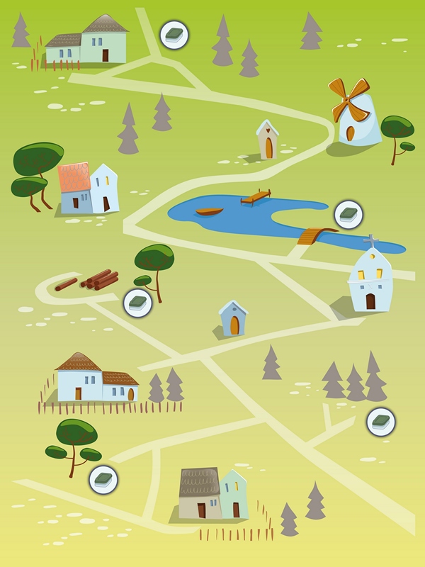
Combining online maps with different data is usually called neo-geography , linking them to specific points on the map. This phenomenon is considered a subsection of neocartography , or folk cartography, when maps are massively created by ordinary people, amateurs. A striking example of a neo-cartographic service is the OpenStreetMap project , and the neo- geographic service is WikiMapia . They are very widely known, so we will not describe them. There are also publicly available databases on a wide variety of topics that can be used in neogeography. And every year the number of amateur cartographers is increasing. For particularly avid participants in this process, the term maphead even appeared in English(cardogol).
The proliferation of the Internet has spurred another phenomenon, a passion for collecting cards - potatoes .

It takes very diverse forms, one of the strangest and most bizarre is cartomania ( cartocacoethes , that rare case when the Russian term is shorter and easier to pronounce), a tendency to see template images of cards in different manifestations of the world. Like this "map of Australia":
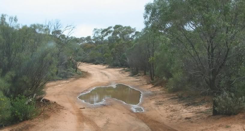
In fact, this is a kind of pareidolia . There was even a comic discipline of “accidental cartography”, when people try to find images of cards in ordinary everyday objects that surround us.
And here's a couple more neo- catchwords : geonerd, which can be translated as geobotan, and geofanat, and traced into geonerd; and topophilia (topography + filia), craving for everything related to the landscape, orientation to the terrain, etc. That is why the entertainment of geocaching is so popular all over the world , a kind of variation on the topic of treasure hunting: someone creates an arbitrary cache and puts out its geographical coordinates, while others must get there and find the cache using these coordinates. Fans of this fun - geokesherov - even formed a kind of division into castes
megakeshery ( megacacher ), the most honored members who have found the most caches (the account goes on thousand);
fast caches (free translation of the termpower cacher ), trying to find as many caches as possible in the allotted time;
ekstremakeshery ( extreme cacher ), which attract only hazardous places and routes;
head caches (free translation of puzzle cacher ) who like to solve different puzzles and puzzles in the process of finding a cache.
Especially appreciated in the community geokesherov so-called " virgin caches » ( a virgin cache ), that is, cache, which is up to you no one has yet found, or could not, or did not have time. The lucky ones in this case proudly call themselves FTF ( first to find , the first to find).
Another amusing hobby, which appeared in the ecosystem neokartografii - Search intersections ( degree Confluence hunt ). People visit places whose latitude and longitude are integer round integers. That is, the intersection points of the parallels and meridians. Naturally, this great moment is recorded in photos and videos confirming your presence in this place.
Why is all of the above so popular around the world? Why do so many people create detailed maps that are not inferior, and often superior to large commercial products? Why are so many people enthusiastically wandering around the planet with maps and navigators at the ready? Probably the answer lies in our brain. When we find the right path in space, our subconscious mind buildscognitive map , mental model of the real world. Therefore, many people like to look at all kinds of cards.
There is even a point of view that the use of navigators, which save us from the need to navigate the terrain, actually block the creation of cognitive maps . Now we very rarely ask for directions and people we meet, because smartphones bring uswhere you need to. It is almost impossible for a modern city dweller to get lost, while we generally look around a little, having buried ourselves in the screens of gadgets on which the route is displayed. On the other hand, if you approach the issue correctly, then the navigator can allow us to get lost much better. The main thing is to hide it deeper and get away. And then you can gladly try to determine your location and search for the road, without fear of getting lost too seriously. Indeed, in your pocket is a navigator that will help you get out, if that. And our task is to look at the world and look for our own path in it.