3D GIS Urban Space Project
The origin of the project
At the beginning of 2014, in the SKB (student design bureau) of my university, which is engaged in developments in the field of 3D technologies, a project of realistic 3D GIS of our city began to develop. Such a big name did not justify itself, since at that moment the prototype had only a 3D component and a substrate with a raster piece of Yandex.Maps. The application was created on the Unity game engine and contained a spatial navigation system for the 3D quarter of our university (Figure 1).
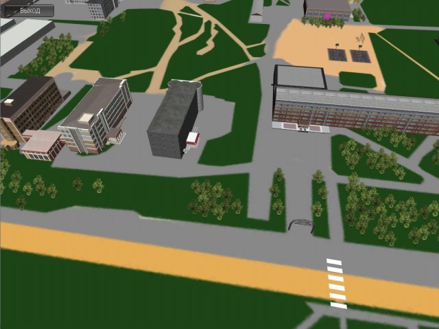
Figure 1 - One of the first screenshots of the project
The paramount task was the creation of an array of realistic 3D models of the buildings of the quarters of one of the city's microdistricts. For this task, each participant of the design bureau was allocated a quarter, and the modeling conditions were not clearly specified, except that the model should be “easy”.
About data collection methods
I will make a small digression, in which I will touch on the methods of studying buildings and collecting materials for subsequent modeling.
There was little experience in such matters, therefore, armed with a camera, I took pictures of houses included in my future 3D quarter. Attempts to create photorealistic textures crashed, so the texture was created in a graphics editor using texture libraries of various materials (Figure 2).

Figure 2 - An example of early textures of a building model.
I note that the Yandex.Maps service - 3D panoramas really helps in the study of buildings. It provides quality detailed photographs of roadside buildings.
Further in SKB
As a result of the work of eight people over four months, eight quarters respectively were created. I was not at all surprised by the result obtained by people isolated from each other, with little experience working with 3D models. The main problem was in some bulky models of large-sized buildings, which were made in such detail that it caused Unity to jerk FPS near such "monsters" (Figure 3).

Figure 3 - An example of the processing of detailed models
My partner and I, apart from the project manager and the main assembler, were hit by the diversity of the obtained 3D models. We had to correct all the flaws in the eight quarters before they hit the map, so as not to spoil the karma.
The sore point of our 3D map was optimization, as I noted above - there were several places on the map in which the FPS fell two, or even three times lower than the average value for the project as a whole. These problems were corrected by creating low-poly counterparts of “heavy” models.
It took about four more months to process heavy models, edit textures, adjust the scale and send the model assembly to Unity. Well, how did we work, there were two of us, both students, employment in the Special Design Bureau is incomplete. Therefore, the timing of the completion of the project stretched to infinity, especially since no specific further goals were set.
And where is the GIS?
As you can see from my story, the project was originally planned as a 3D GIS, but there was no database or reference to any coordinate system (geoinformation).
It is worth noting that the prototype database of buildings was developed and tested by me. It represents the simplest information about the building and the camera’s binding to the center of the object with the effect of “searching” the object by name.
A cut atlas of satellite Yandex.Maps is used as a substrate, but in the initial versions, a raster map outline, a vector drawing, and a map plotted on terrain were used. One of the problems with this method was the updating of satellite imagery at the end of 2015, because of this, the entire substrate will have to be redone. But there is an alternative. In the Asset Store, I came across the plugin "Google Maps for Unity", its meaning is in the interactive loading of Google. Maps on the plane and not only. Unfortunately, the API version of this plugin is already outdated and therefore it was not possible to use it. He has an alternative, from the same developers, but for $ 60 already.
Prospects
Our project is frozen. We received a small incentive by winning a diploma with this project at the 2014 Innovation Youth Convention. The city administration was interested in our developments.
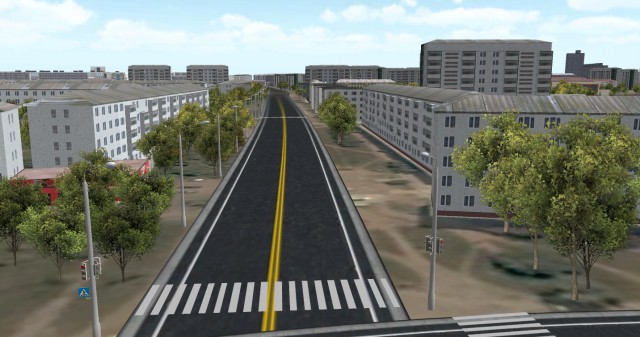
Fresh project screenshots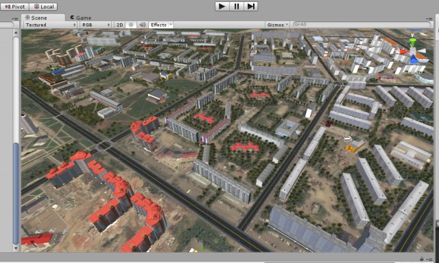
You can test the test Online version of the project at the following link:
3D map online
Guys, I bought a premium account for hosting, now there will be no problems with access! Thank you for your interest!)
Conclusion
I wanted to note that there are few articles about 3D GIS, in particular, there are commercial large-scale projects that I did not consider in my article (Sity ENGINE, Infrastructure Modeler and others).
PS
Thank you for attention! I hope this topic is close to someone, I expect informative comments.I completely forgot - everyone can see our article in the electronic scientific publication "Scientific notes of PNU" at the following link: Scientific article - REALISTIC MODEL OF URBAN SPACE
PS part two
Thanks for the comments comrades! I learned a lot of useful information for myself, I will learn Open Street Maps, in particular the Kendzi3D plug-in for 3D buildings.