June 23, 2016 at 16:32
Closed gestalt and a lot of meat at the Ukrainian cartographic conference
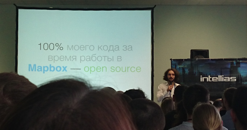
In early June, the Lviv company Intellias suddenly held a Map Solutions conference in Kiev. Without much advancement in Russian blogs, she gathered one and a half hundred Ukrainian developers and a dozen speakers from different countries. A nondescript empty business center, a model hall, tea-coffee-cola - the recipe for an ideal conference. There are three official languages, and some speakers were preparing to speak in English, but, seeing the participants live, listening to their ideal Russian language (with an interesting accent), changed their minds. Reports and breaks were announced, however, all the same in three languages, and it looked surreal: as if you were actually sitting at an international conference. I have not seen this before.
The first speaker, Kirill Dmitrenko from Yandex, has been working on panoramas for so long that some photos make him sick. He prepared a presentation in English - with such a small print that he had to strain. This is the scourge of techies: people, feel free to write words all over the wall. Cyril explained the theory of building and displaying panoramas. At first, they wrote a rendering in Canvas 2D in Yandex: they cut a large photo into triangles, counted it into screen coordinates, and painted. But here's the bad luck: Canvas is slow, especially on mobile devices and for some reason in Firefox. Sometimes the panorama was loaded for half a minute. But then WebGL arrived, they rewrote everything on it, and complex calculations were not needed. I had to fight only with restrictions on the size of the textures (4K is safe, then where), but they decided to cut them into squares. The second half of the report was about the Yandex.Panoram API, and on a dozen questions “Can I do it the way I need?” Kirill had to answer: “No, only as we allowed, but we will think, thanks.”
The hall was small, which is why it is crowded, decent speakers, everything is audible. Presentations were recorded on camera and recently posted photos and videos. Perhaps, the lecture of Viktor Shcherba from OsmAnd needs to be re-listened: he revised the report on creating map styles from Open GIS, making a dense set of tips on every aspect - from choosing colors and a set of objects to the consistency and authoritarianism of the designer. At the beginning, he asked who does not know about OpenStreetMap: about ten people (including me) raised their hands. It was strange that with an abundance of words about sizes and colors in 20 minutes, Victor did not show a single illustration. Then came the screenshots, OsmAnd, paid updates, and more. The first question from the audience was about monetization (very exciting), the last - why Kiev wasn’t signed on a viewing scale.
Andrey Golovin from Mapbox started traditionally for the osmere - with a live broadcast of Show Me The Way . And then, in the context of Mapbox’s interest in car navigation to the lanes, he arranged a workshop on road tagging in OpenStreetMap. With an emphasis on drawing movement in stripes: I even mentioned the ancient plug-in for visual creation of eerie relationships that experienced osmerians tried so hard to forget. JOSM was thickening on the screen, I periodically lost the thread of the story, and what it was to the uninitiated participants, I’m afraid to imagine.
Continued the attack with obscure terms and technologies of Mapbox Vladimir Agafonkin. He no longer talks about Leaflet, instead he mentions vector tiles and a million libraries that help you work with them - turn vector data into them and vice versa - and quickly display the result in a browser. The keynote of his presentation is “but I did not find suitable tools, so I wrote my own library, which does it faster than others.” At the end of the next "his library" the hall neighing. And I wrote down the only link that might come in handy: Protozero for fast reading and writing protobuf format.
Lunch. Meat, a lot of meat and no queues. I love the organizers. At the table I talked with Alexander from Intellias. Engaged in geocoding on an industrial scale, everything is optimized: clouds, loading into memory, and the like. He does not understand our open source problems with the opening of the Nominatim. Around the wanderings were entirely the employees of Intellias - the organizer of the conference, who had no reason to be ashamed to breed self-PR - and Intetics, a similar Kiev company. Those and other outsourcers also work with cartography. Only Lviv residents have a large client with a cartographic project, thanks to which we all gathered.
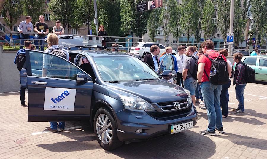
Then went down to the parking lot to watch the cartographers machine Here. Once upon a time I found an articleabout the Navteq cartographic crews, servers in the trunk, GPS inertial corrections and tablets on which the passenger notes everything that he sees. This predetermined the passion for collecting data for OpenStreetMap from a car and sowed the dream of looking at such a machine closer. Years passed, Nokia bought Navteq and renamed it Here, then the auto consortium bought out Here. And so we met, much closer: the cartographers put us passengers and drove along the block, explaining what and how they draw on the tablet and where the collected stuff goes then.

Everything is already familiar: two people per car, change places periodically, 40–50 km a day in the city, and 200 can be found in the country. An exact track is going along, seven videos from seven cameras, sound from the microphone (though, because of matyukov decided to refuse it). Every day, an Atlas app launches a new project that adds up data; on top of the map you can draw, on the screen a hundred buttons about the quality and class of the road, fences, pits, traffic. The application is the same as ten years ago, written in Java, runs under Win XP and stores data in the Oracle database on the same servers in the trunk. In Ukraine, cartographers with two machines collected all roads of a residential level and higher, in some cities in general everything. True, “everything” in the context of Here is a traffic situation and addresses: they have no purpose to create a POI catalog or circle forests.
I missed the report of Carlos from CartoDB because of the trip, about whom they said that he was very good, and got back to Here (they asked not to publish their notes). Andrei Shnyr promised to talk about incremental updating of offline maps, and I was all in anticipation, because we are starting to think about this topic in MAPS.ME. To the first question - who uses the Here navigation in the audience - one third of the participants raised their hands. I am in shock. What do you mean why? Explaining the way to the pub after the conference, the organizer complained that there is no point in looking for the address in the navigator, you still won’t find it. I did not believe it, entered the street and the house in MAPS.ME and immediately got a walking route to the desired point. The pub itself was not marked, but it’s not in vain that we have the Add Place button. I don’t understand why all these people chew Here cactus, just because of the advertising? I heard that the company plans to move four hundred employees to Kiev,
Maria from the organizers of the conference especially asked to choose a technical topic, applicable in practice, something interesting to programmers. It was evident that many speakers tried: if not about specific APIs, like in panoramas and Mapbox, so about algorithms and data structures, like me and Nikita. Andrei was the only one who surprised everyone, devoting almost his entire report to advertising Here and its products. 30 gigabytes worldwide! 200 layers! (What?) And here's a commercial for you (as usual, the player has malfunctioned). At the end - two slides: incremental updates are binary (a la diff / patch) and semantic (considering the format). All. However, I learned from the presentation about the universal format of NDS cards , which takes into account the possibility of updating. True, under it, it seems, they mean the downloading of entirely separate layers to separate regions.
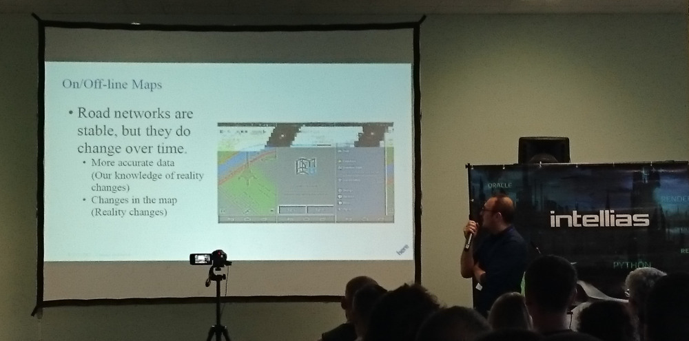
Alex Gonopolsky continued the theme of Here, talking about the very updates that everyone was waiting for. But since Here focuses on the road network, they are also interested in specific updates. Alex calculated that only 1.6% of the road graph changed in Berlin in 2013, and the nature of the changes is different: roads were built somewhere, speed limits changed somewhere, and in the data, in any case, this is considered a new segment. We are looking for the most optimal way to calculate and send user changes to the road network so that you do not have to download megabytes via GPRS.
Map updates are sent at the time of building the route on the server. The problem is the intersection and replacement of identifiers. Consistency at the boundaries of updated data is also important so that new roads do not end in a dead end. Solution: along with the route changes in the road graph are sent, but only those that are not far from the route receive only nothing tiles (yes, the maps are divided into tiles about 0.001 ° in size, judging by the slides). And they check that there are no dead ends on the borders of the tiles. Sometimes it may be cheaper not to update the map, but to build a detour route according to old data.

Nikita Platonenko works for a company with the ambiguous name FamilyInSafe. Something about communication within the family and automatic check-ins with a grouping of frequently visited places. So the whole report is about clustering algorithms, both "bicycle" and the popular DBSCAN with mention of k-means. Unexpectedly informative and technical, I even understood how clustering works: just around each point we draw an imaginary circle and combine the intersecting ones. And before that, I considered it magic, for which it is better to find a library and not bother. But Nikita has no such option: he does not work with Leaflet , but with Google Maps and Google Places.
I spoke my report very quickly, because instead of 40 minutes, like all of the above, I took 20. I talked about OpenStreetMap data compression formats and interesting algorithmic findings inside them. The missed deadline allowed not to answer a hundred questions about MAPS.ME - now I understand that it’s in vain.
The presentation of Sergey Shelkovnikov from GISFile was too abstract. Geodata storage is a very specific topic: give me a task, get formats and applications. But Sergey for a very long time explained some basic things, such as the difference between the main and additional layers and loading them into the database. I was waiting for OSM rhymes, but in the context of the report he was mentioned only as tiles for the background. “You can, you can, you can”: little specificity, an excess of vague advice.
We at OpenStreetMap roughly represent the cartographic side of indoor navigation, and Vladislav Ivanov from QROKtold about the technical. He deals with beacons: boxes with iBeacon (working on BLE) and Wi-Fi. The receivers still seem to be using accelerometers. I liked that the lighthouses are produced in Odessa. Three lighthouses in visibility are enough for navigation, more is better, but when there are 15 of them, they begin to interfere with each other and the system goes crazy. Yes, and reflections: on the street with GPS, it is enough to move away from the wall of the building, but inside there are entirely walls and ceilings. The problem of reflections was solved elegantly: they made up the base of the readings of the receivers for all points of the room with a step of two meters and they did not calculate the position, but simply looked at the table. The complexity of adding a new beacon is not clear, or how a decrease in their power will affect the accuracy of positioning.
After setting up the beacons and measuring the signals, you need a map for the application in order to see where which store is and plot routes. It is also important to note dead zones, such as utility rooms and toilets. Andrey Petrov on the previous “Circuitry” spoke in detail about drawing rooms in OSM , Here has a large collection of shopping centers, but QROK has partnered with Google Maps. And it seems that they have to draw schemes for the fuel dispensers themselves. The reception accuracy is 1–5 meters, the beacons operate on the battery for two years, but just in case they are checked more often: if the battery has run out, the beacon cannot be found, it is too small. They want to solve this trouble by embedding beacons in the power grid - for example, in lighting. I also found out from the answers that Wi-Fi location determination works only in Android, there are no rights on iOS.
The conference ended, among the photos posted on Facebook, TomTom played a clock, choosing a winner using random.org . Then the "information bar" about the pub, and everyone fled. Having sent people around the sidewalk, I checked the direct pedestrian route from MAPS.ME - I made my way through the bushes and went down the abandoned stairs, from where I went right onto the right street. The waiters in the pub were horrified by the number of people: they were not warned, and all orders were prepared by a single chef. We sat long enough to wait for him, but for some reason in groups: osmeri, programmers, bloggers, organizers, Here employees. The beer was delivered quickly, the conversation was sticking, it was already evening, we caught up with the developers of OsmAnd tea at the Chocolate House and went home.

Ukraine rarely appears in geoinformation news. I could only remember the GIS Forum, which was held in Kharkov in March, and a couple of Oleg Seliverstov's initiatives about nature reserves. At the same time, there are many developers, many orders for cartography, indoor development, all Mapbox employees in Eastern Europe live in Ukraine, and Here again is eyeing the country. For half a year, Ukrainians have been making a modern bilingual blog 50 Northabout cartography news - a sign of a growing community. Map Solutions conference is important not only because it brings together interested people in cartographic technologies from different countries for a day - this is one of the ways to attract new people to cartography and grow your own neocartographic industry. We at OpenStreetMap can use these events to educate people and bring them to open technologies and geodata. The main thing is to participate more often.