Using satellite images, archaeologists have discovered an unknown Viking settlement in the New World.
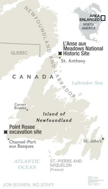
Archaeologist Sarah Parsak [Sarah Parcak] from the University of Alabama in Birmingham discovered another Viking settlement in the south of Newfoundland, in an area called Point Rosee. Before this, only one Viking settlement was known, in the north of the same island. Parsak discovered the location of the ruins of ancient buildings using digital analysis of satellite photographs of the area.
At the moment, among scientists it is considered that of all the Europeans, it was the Vikings who first discovered North America, despite the fact that this continent was inhabited by indigenous peoples for more than 11 thousand years before. It happened at the end of the 10th century AD, around the year 986, 500 years before Columbus. Archaeological evidence confirming the veracity of the sagas, the Saga of Eric Redhead and the Greenlanders Saga, was discovered in 1960 in the town of L'Annes-o-Meadows on the island of Newfoundland. The Vikings called the land they had discovered Vinlandia .
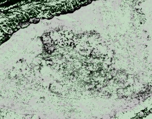
An example of a satellite image with which Parsac worked.
Sara Parsac belongs to the so-called. space archaeologists - followers of the modern trend in this science, who use satellite photos to analyze the features of the planet's surface. Often such an analysis helps to find traces of the ruins of ancient settlements. Even being buried under a layer of soil, the ruins affect the retention and redistribution of moisture in it, and thus, indirectly, the distribution of vegetation on the surface. Computer analysis and visual inspection of high-resolution photos helps to detect such deviations.
Sarah Parsak, Egyptologist and assistant professor of archeology, using this method, has already found in 2011in Egypt, 17 lost pyramids, more than 1,000 tombs and 3,100 ancient settlements using infrared satellite imagery. She and her team were able to detect previously invisible structures, including streets with many houses, tombs and pyramids. After working with satellite images, a team of French archaeologists carried out excavations in the indicated places and confirmed that Parsac was not mistaken.
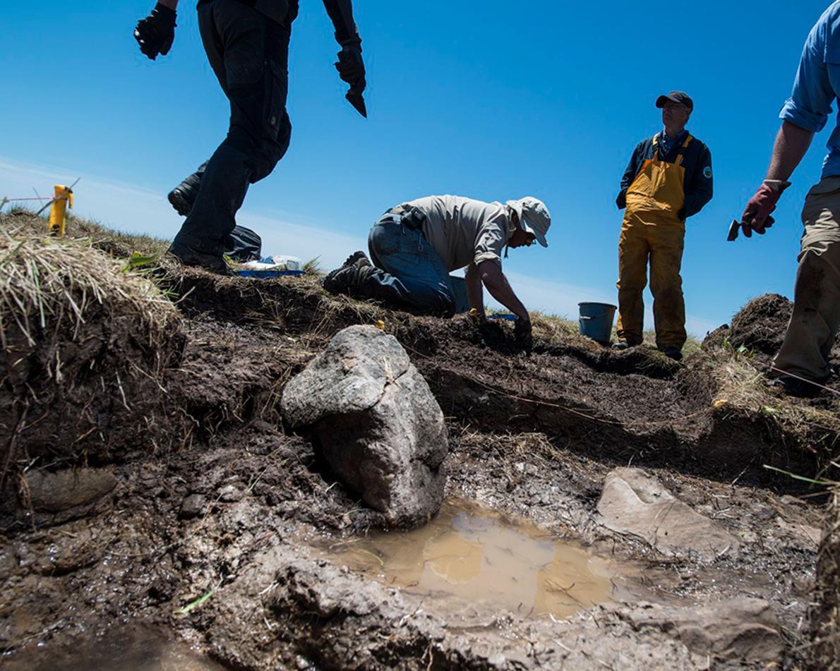
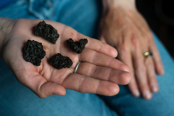
Having found the place of the supposed settlement of the Vikings, the team of Parsac began excavation, and with the help of a magnetometer came across 14 kilograms of iron slag that had lain all the time in the ground, indicating the place of manufacture of weapons and labor tools by the Vikings.
It is not yet known for sure whether the Vikings called Vinland only the island of Newfoundland, or whether they reached the mainland mainland of Canada. The discovery of a new settlement encourages archaeologists and allows them to hope for new and interesting discoveries that can expand the history of ancient peoples known to us.
Previously, the joint work of archaeologists from Harvard University and the Massachusetts Institute of Technology in 2012, who developed their own method of processing satellite images, made it possible to find several thousand previously unknown settlements in northeastern Syria . The oldest of them are eight thousand years old.