"How to measure a bunch" or surveying today
Have you ever wondered how to calculate the amount of material? In the production of any construction work, one has to face problems in calculating volumes, whether it is expensive asphalt, or a lot of construction waste from the construction site. It is easy enough to estimate a few cubic meters of material in the mind - the whole calculation comes down to determining the number of cubes.
But what to do when you have several thousand cubic meters of soil spread out randomly over a large area? Not so long ago, such tasks scared many surveyors because of the complexity of the process, and the high possibility of making a mistake. Now, thank God, the age of high technology, and the method of quick and accurate calculation has existed for many years.
In fact, a skilled worker is very easy to do. The surveyor, engaged in calculating the volume, performs work in several main stages, which, in turn, allow you to quickly cope with the task and with greater accuracy than was possible before.
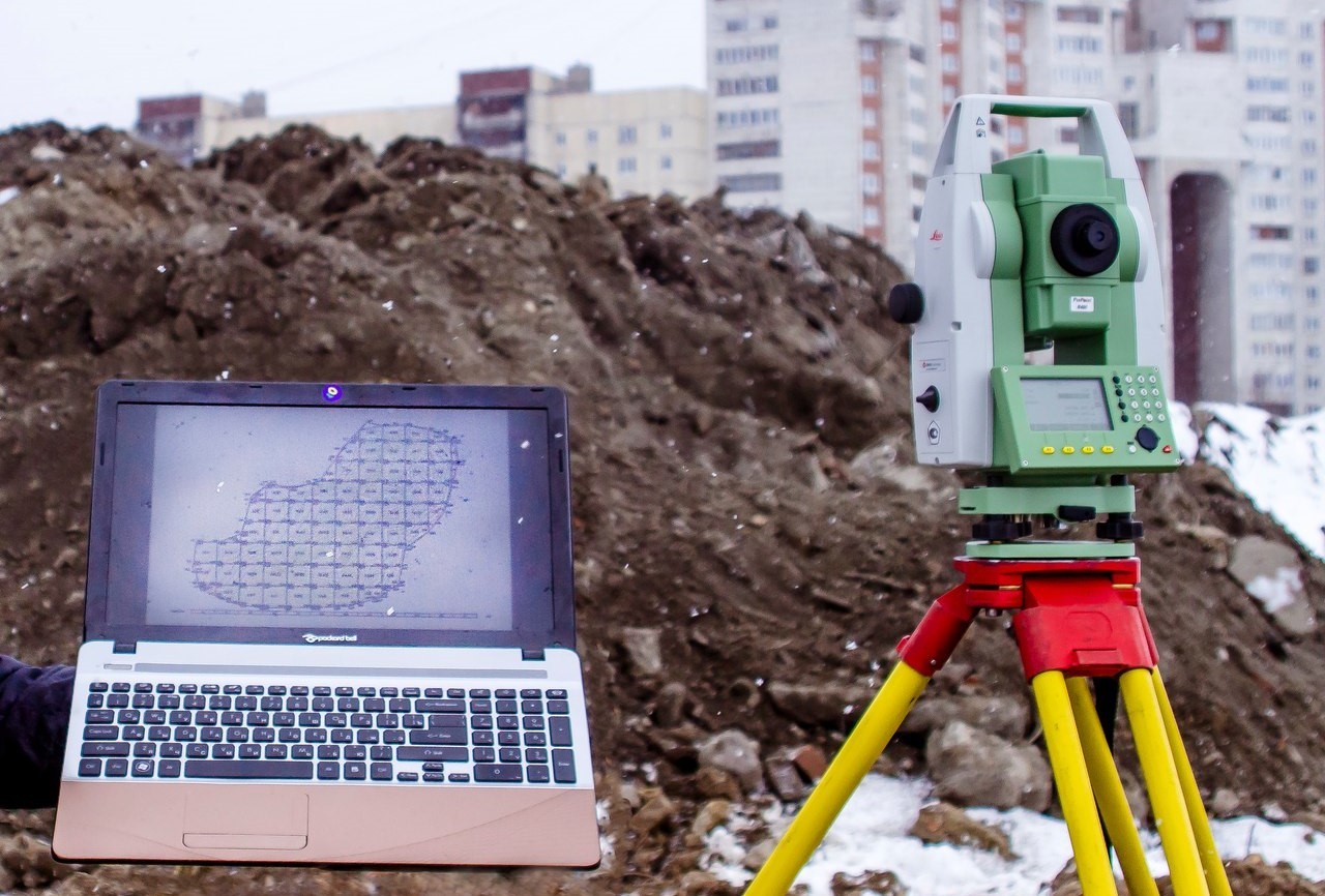
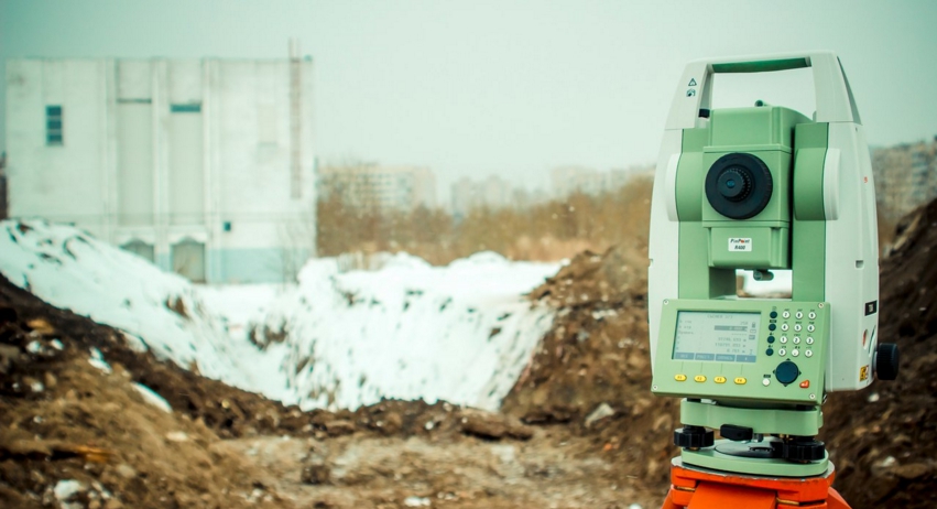
At the first stage, it is important to perform the total survey as accurately as possible and carefully process the data. When researching, do not be lazy to rearrange the device for a better view of the object. The result will be accurate enough after a few hours. The error in the derivation of data on such work is within 5%. This value is achieved by precisely observing the geometric parameters of the measured body. While the previous methods of calculation took several days and had a more significant error.
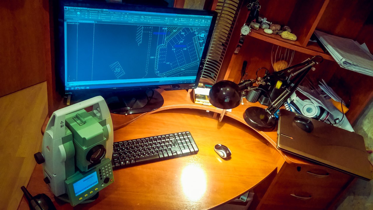
Data processing and volume calculation are the second stage. Having experience working with geodetic instruments and programs designed to calculate volumes, you cease to be amazed at the capabilities of modern software. Thanks to working with them, maximum accuracy is achieved, and human errors are practically eliminated, since manual calculation is not used in this method.
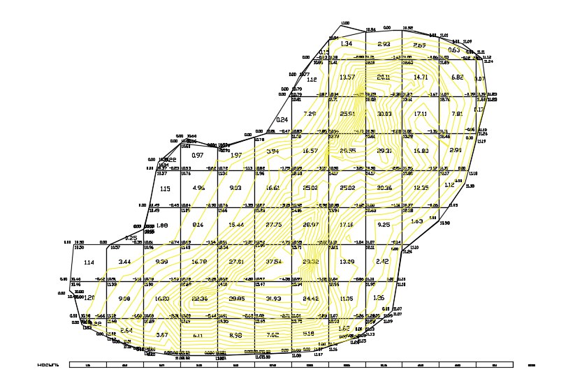
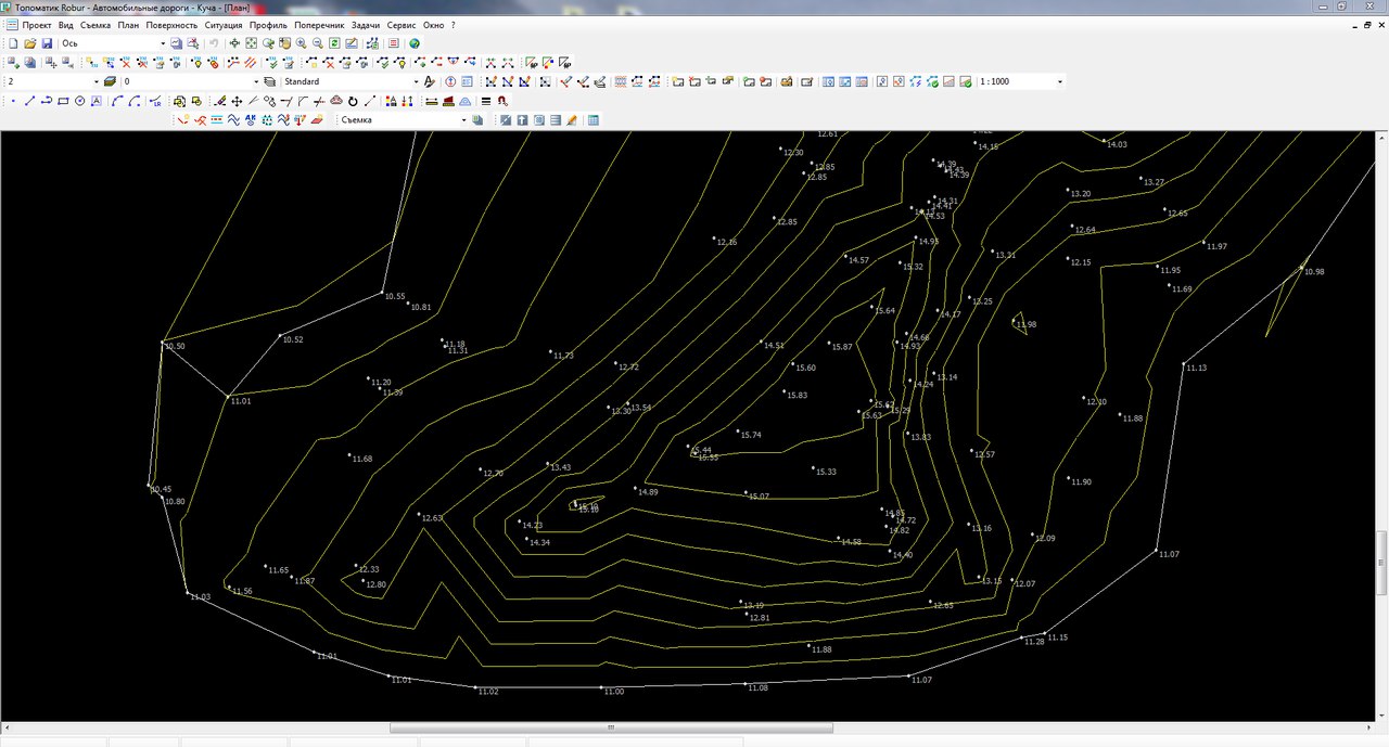
At the third and final stage, we display the result in the form of a cartogram. The cartogram is a clear demonstration of the distribution of earth masses in a given contour. Also on the drawing are several more indicators that help to understand the full picture. Along with the volume, you can find information about the working elevation, the local size of the layer and the elevation of black earth in a given area. All values of these indicators are calculated automatically, which greatly speeds up the calculation process.
One, no less important factor, is the processing of the information received. When processing data, we use the Topomatic Robur software package, designed specifically to solve the problems that engineers face in the design and construction of roads.
The whole essence of the work in this program comes down to setting two surfaces (top and bottom) electronically and calculating the volume enclosed between these two surfaces. The main thing is to carefully set all the parameters for calculating the cartogram, and if everything is done correctly, the result will be displayed in the drawing. If you need further use and editing of the cartogram, many software systems are suitable. Thus, the result can be displayed in the most convenient and simple form for each user.
And now, the cartogram is ready. It contains all the necessary data for the further work of accountants and designers. All this work now does not take much time at all, not counting the time spent on the total station survey, and in case of urgent need, the result can be obtained on the spot.
Thus, what in the recent past took a few days of work by surveyors and could not accurately show the actual volume, besides costing not a lot of money, is now no more difficult than breaking the foundation, respectively, and much cheaper. Another plus is the ability to calculate heaps of absolutely any geometric shapes and sizes.
ps Thanks to the guys in the field of construction surveying who provided this material.
That's all, about errors and inaccuracies found in the text it is better to write in the LAN. With you was a simple service for choosing sophisticated Dronk.Ru equipment . Do not forget to subscribe to our blog , there will be many more interesting things.
Our other publications:
Onda and its tablets - can you trust the “Chinese”?
Review of the budget 8 "tablet Chuwi Vi8 Plus on Windows 10 for $ 88
an overview of the powerful tablet Chuwi Hi10 at full Win10 for $ 180
Seven actual copter to $ 20, which you can put in your pocket
The company Xiaomi cheaper without sacrificing the quality is no longer the case.
Chuwi iLife V5 - a robot $ 99 vacuum cleaner or how to turn daily cleaning into entertainment
NEJE engraving laser review or a promising business model
PSS And also, right now we are having a raffle of a smart bracelet from Xiaomi .
But what to do when you have several thousand cubic meters of soil spread out randomly over a large area? Not so long ago, such tasks scared many surveyors because of the complexity of the process, and the high possibility of making a mistake. Now, thank God, the age of high technology, and the method of quick and accurate calculation has existed for many years.
In fact, a skilled worker is very easy to do. The surveyor, engaged in calculating the volume, performs work in several main stages, which, in turn, allow you to quickly cope with the task and with greater accuracy than was possible before.
Stage 1
At the first stage, it is important to perform the total survey as accurately as possible and carefully process the data. When researching, do not be lazy to rearrange the device for a better view of the object. The result will be accurate enough after a few hours. The error in the derivation of data on such work is within 5%. This value is achieved by precisely observing the geometric parameters of the measured body. While the previous methods of calculation took several days and had a more significant error.
Stage 2
Data processing and volume calculation are the second stage. Having experience working with geodetic instruments and programs designed to calculate volumes, you cease to be amazed at the capabilities of modern software. Thanks to working with them, maximum accuracy is achieved, and human errors are practically eliminated, since manual calculation is not used in this method.
Stage 3
At the third and final stage, we display the result in the form of a cartogram. The cartogram is a clear demonstration of the distribution of earth masses in a given contour. Also on the drawing are several more indicators that help to understand the full picture. Along with the volume, you can find information about the working elevation, the local size of the layer and the elevation of black earth in a given area. All values of these indicators are calculated automatically, which greatly speeds up the calculation process.
High accuracy factors
One, no less important factor, is the processing of the information received. When processing data, we use the Topomatic Robur software package, designed specifically to solve the problems that engineers face in the design and construction of roads.
The whole essence of the work in this program comes down to setting two surfaces (top and bottom) electronically and calculating the volume enclosed between these two surfaces. The main thing is to carefully set all the parameters for calculating the cartogram, and if everything is done correctly, the result will be displayed in the drawing. If you need further use and editing of the cartogram, many software systems are suitable. Thus, the result can be displayed in the most convenient and simple form for each user.
The triumph of engineering
And now, the cartogram is ready. It contains all the necessary data for the further work of accountants and designers. All this work now does not take much time at all, not counting the time spent on the total station survey, and in case of urgent need, the result can be obtained on the spot.
Thus, what in the recent past took a few days of work by surveyors and could not accurately show the actual volume, besides costing not a lot of money, is now no more difficult than breaking the foundation, respectively, and much cheaper. Another plus is the ability to calculate heaps of absolutely any geometric shapes and sizes.
ps Thanks to the guys in the field of construction surveying who provided this material.
That's all, about errors and inaccuracies found in the text it is better to write in the LAN. With you was a simple service for choosing sophisticated Dronk.Ru equipment . Do not forget to subscribe to our blog , there will be many more interesting things.
Our other publications:
Onda and its tablets - can you trust the “Chinese”?
Review of the budget 8 "tablet Chuwi Vi8 Plus on Windows 10 for $ 88
an overview of the powerful tablet Chuwi Hi10 at full Win10 for $ 180
Seven actual copter to $ 20, which you can put in your pocket
The company Xiaomi cheaper without sacrificing the quality is no longer the case.
Chuwi iLife V5 - a robot $ 99 vacuum cleaner or how to turn daily cleaning into entertainment
NEJE engraving laser review or a promising business model
PSS And also, right now we are having a raffle of a smart bracelet from Xiaomi .