Real virtuality: an information model of the city
My specialty is architect, and I want to tell you a little about my work. I hope it will be interesting and quite in the spirit of an IT resource. Since this is a sightseeing tour, we will start from the very beginning and see what stages the project will have to overcome before the real building appears.
The very first step is called “investment rationale”. The customer comes to the design firm and offers a choice of site and several possible use cases - or several sites for a given purpose (in our case, for a small cafe). The customer has no ideas, there is no fix, he would like to “turn out something like that right away”. We will determine the place, type of service and target audience.
To begin with - an analysis of the initial situation. I log in to the virtual model of the city, upload a 2D plan. In order to have a connection to the system, you need a license. I log in through the organization’s account. Private traders are most likely deprived of all the “goodies” that I use so shamelessly.
The district will not be central, it will not be oversaturated with competitors ... I highlight a large piece of territory, adjust the filter and highlight the catering establishments. First, for clarity, I build Voronoi's partition .

Now demand conestaking into account the number of places in establishments, price category and reviews on the Internet. You can load any database into the “service coverage analysis” tool, for processing of which only you can come up with a formula. It is clear that the base that you personally formed, unlike the general one, is itself not updated, but not so often this is necessary, you can use pens. Or use publicly available data and filters, periodically after testing new ones are added.

I put two diagrams on top of each other and see “overloaded” and promising areas. Ideally, the boundaries of the breakdown in two cases would coincide, but in real life this does not happen. I choose one of the options proposed by the customer. In principle, it was already so obvious, but you can’t attach intuition to the project. Now I’m building everything anew with the new “virtual” cafe. But the result is still far from ideal.

Let's try to “play” with the target audience. I load the list of nearby establishments, description, ratings ... Not a single children's cafe or game center. Let's check what we have with demographics. I switch to another analytical tab, I am waiting for the construction of diagrams of the age and sex structure of the population of the selected area of the city, I am scrolling the dynamics five years ago and forward, building a new demand cone. Promisingly. We will design a family cafe with the possibility of expansion - just in case.

I go to the model repository, download a few surrounding buildings in a low-poly form, and I ask for the detailed one to which we will attach our own. Freshmen-architects make simple models on computer science laboratories for free, but detailed ones have to be ordered for some money or riveted on their own. But then the company has bonuses for downloading them for uploading them to the database.
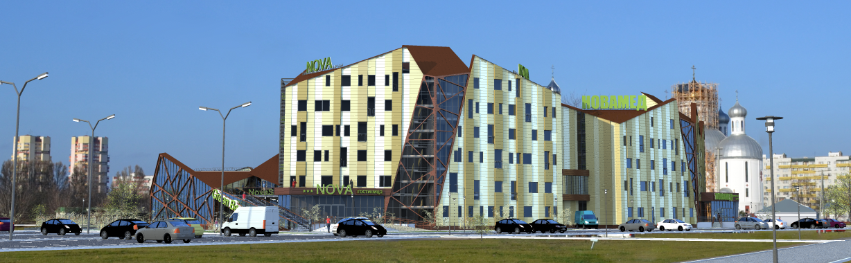
The second stage is a “draft design”. Usually three options are made for comparison. I make concepts, embed the existing 3D scene of the site, render with each option a “virtual reality sphere” for viewing in a browser. I’m checking if there is a Google panorama for “my” street to embed my picture into it, but this time not. I write a colorful explanatory text and put it together with panoramas in the form of public discussion. For our area of the city this is not necessary, only for the historical center, but people are always more loyal when asked their opinion.

We’ll look at the reaction of the district’s inhabitants in a week, and for now I’ll deal with the planning and functional part of the project. For all visually different pictures, the “filling" will be almost the same. This is the third stage, it is called the “architectural project”. From a professional point of view, it’s also interesting, but it’s not so interesting to read about the routine.
And now I have to admit: I'm deceiving you. Virtual cities do not exist. You do not need comprehensive information models and interconnected databases about all aspects of the life of the city and its inhabitants. None of the analysis and design tools described has yet been developed. Even the idea of a city-wide library of models of real buildings does not soar in the air, let alone finer materials.
Automation concerns only the mechanics of drawing, and the main decisions are made the old fashioned way, intuitively, based on inaccurate and outdated data. All that you have just read is pure science fiction. I hope that someday it will come true, but while the analytical approach to urban planning and architecture is making its way very slowly, the apparent laboriousness outweighs the advantages invisible to the naked eye.
PS Illustrations, of course, were created in a graphical editor, any similarities with really existing programs and structures are random.
The very first step is called “investment rationale”. The customer comes to the design firm and offers a choice of site and several possible use cases - or several sites for a given purpose (in our case, for a small cafe). The customer has no ideas, there is no fix, he would like to “turn out something like that right away”. We will determine the place, type of service and target audience.
To begin with - an analysis of the initial situation. I log in to the virtual model of the city, upload a 2D plan. In order to have a connection to the system, you need a license. I log in through the organization’s account. Private traders are most likely deprived of all the “goodies” that I use so shamelessly.
The district will not be central, it will not be oversaturated with competitors ... I highlight a large piece of territory, adjust the filter and highlight the catering establishments. First, for clarity, I build Voronoi's partition .
Now demand conestaking into account the number of places in establishments, price category and reviews on the Internet. You can load any database into the “service coverage analysis” tool, for processing of which only you can come up with a formula. It is clear that the base that you personally formed, unlike the general one, is itself not updated, but not so often this is necessary, you can use pens. Or use publicly available data and filters, periodically after testing new ones are added.
I put two diagrams on top of each other and see “overloaded” and promising areas. Ideally, the boundaries of the breakdown in two cases would coincide, but in real life this does not happen. I choose one of the options proposed by the customer. In principle, it was already so obvious, but you can’t attach intuition to the project. Now I’m building everything anew with the new “virtual” cafe. But the result is still far from ideal.
Let's try to “play” with the target audience. I load the list of nearby establishments, description, ratings ... Not a single children's cafe or game center. Let's check what we have with demographics. I switch to another analytical tab, I am waiting for the construction of diagrams of the age and sex structure of the population of the selected area of the city, I am scrolling the dynamics five years ago and forward, building a new demand cone. Promisingly. We will design a family cafe with the possibility of expansion - just in case.
I go to the model repository, download a few surrounding buildings in a low-poly form, and I ask for the detailed one to which we will attach our own. Freshmen-architects make simple models on computer science laboratories for free, but detailed ones have to be ordered for some money or riveted on their own. But then the company has bonuses for downloading them for uploading them to the database.
The second stage is a “draft design”. Usually three options are made for comparison. I make concepts, embed the existing 3D scene of the site, render with each option a “virtual reality sphere” for viewing in a browser. I’m checking if there is a Google panorama for “my” street to embed my picture into it, but this time not. I write a colorful explanatory text and put it together with panoramas in the form of public discussion. For our area of the city this is not necessary, only for the historical center, but people are always more loyal when asked their opinion.
We’ll look at the reaction of the district’s inhabitants in a week, and for now I’ll deal with the planning and functional part of the project. For all visually different pictures, the “filling" will be almost the same. This is the third stage, it is called the “architectural project”. From a professional point of view, it’s also interesting, but it’s not so interesting to read about the routine.
And now I have to admit: I'm deceiving you. Virtual cities do not exist. You do not need comprehensive information models and interconnected databases about all aspects of the life of the city and its inhabitants. None of the analysis and design tools described has yet been developed. Even the idea of a city-wide library of models of real buildings does not soar in the air, let alone finer materials.
Automation concerns only the mechanics of drawing, and the main decisions are made the old fashioned way, intuitively, based on inaccurate and outdated data. All that you have just read is pure science fiction. I hope that someday it will come true, but while the analytical approach to urban planning and architecture is making its way very slowly, the apparent laboriousness outweighs the advantages invisible to the naked eye.
PS Illustrations, of course, were created in a graphical editor, any similarities with really existing programs and structures are random.