Get ready for 2017 total solar eclipse
- Transfer
- Tutorial

Get Ready for the Total Solar Eclipse of 2017 post translation by Jeffrey Bryant, Software Researcher, Wolfram | Alpha Scientific Content.
________________________________________________________________________________
On August 21, 2017, an event will occur in some parts of the western hemisphere that most people have not seen before throughout their lives. A total eclipse of the sun will cover the surface of the United States and nearby oceans. Although eclipses of this type are not uncommon around the world, the likelihood that this will happen next to you is quite small - and often happens only once in your life, unless, of course, you travel around the world regularly. This year, the total eclipse will be at an acceptable distance for a car trip for most people in 48 continental states.
A total eclipse of the Sun is the result of the movement of the Moon in front of the Sun, from the point of view of an observer on Earth. The shadow of the moon is quite small and only comes in contact with the earth's surface in a small area, as shown in the following illustration.

We can use Wolfram 3D graphics to create a more realistic visualization of this event. First, we use texture to make the Earth more realistic.

Apply the texture to the rotated spherical surface as follows.

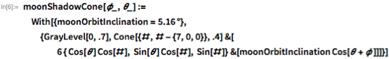
We will present the shadow of the Earth as a cone.

The moon can be represented as a simple sphere ( Sphere ), offset from the center of the model, and its orbit is a simple dotted 3D path. Both objects are specified through the model parameters, since the orbit of the moon will experience a precessional motion in time. It is useful to be able to convey values to these functions in order to make the shadow align with the line we need.


Like the earth’s shadow, we present the moon’s shadow as a cone.
Finally, we create some additional model elements for use as annotations.

Now we just need to assemble the model. We want the moon to be on the same axis with the sun, so to achieve this we use the value 0 ° for one of the parameters. To take into account the precession of the orbit so that the shadow falls on North America, we use the value of 70 ° for the second parameter. The rest is just styling information.


This means that due to deviations from the circular path of the orbit, the moon is sometimes located farther from the Earth than at other times; it also means that due to the inclination of the orbit, it may be above or below the plane of the Earth-Sun orbit. Usually, when the Moon passes “between” the Earth and the Sun, it is “above” or “below” the Sun from the point of view of an observer on the surface of the Earth. Other effects affect the geometry, but the geometry builds up well from time to time, and the moon actually blocks part or all of the solar disk. On August 21, 2017, the geometry will be “just right”, and in some places on Earth, the Moon will cover at least part of the Sun.
In addition to illustrating the eclipse geometry, we can also use the Wolfram language, namely the GeoGraphics functionto create various maps showing where the eclipse will be visible. By writing a little code, you can get detailed results. For example, we can combine the features of SolarEclipse with GeoGraphics to show where you can see the path of the total solar eclipse of 2017. The total eclipse phase will be visible in the narrow band that crosses the central United States.

So which states will see a total solar eclipse? The following example can be used to determine this. First we extract the polygon corresponding to the full phase of the upcoming eclipse.


Suppose you want to zoom in on a particular state to look at it in more detail. At this level, we are only interested in the path of the total solar eclipse and the center line. Once again, use SolarEclipse to get the necessary elements.


Then simply use GeoGraphics to generate a map of the state in question - in this case, Wyoming.

We can use the Wolfram Data Repository to obtain additional information on the eclipse, for example, the time of the eclipse in various places.


We can use this data to construct annotated timestamps for various points along the eclipse path.

Then we just combine the elements.

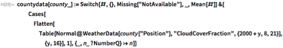
Of course, even if an eclipse occurs, there is no guarantee that you can attest to it. If the weather is bad, you will just notice that it will become dark in the middle of the day. Using WeatherData , we can try to predict which regions are expected to be cloudy on August 21. The following example is based on a similar publication by the Wolfram community .
The following code retrieves all the districts that intersect the boundaries of the eclipse polygon.

Most of the work involves estimating the “ CloudCoverFraction ” values for each district on August 21 for each year from 2001 to 2016 and finding the average value for each district.

Then use GeoRegionValuePlot to plot these values. In general, it seems that most areas along this path have a relatively low probability of cloudy weather on August 21 based on historical data.

A total solar eclipse on August 21, 2017 is no laughing matter - because the path passes through a large territory of the United States. Do your best to see it! Observe the necessary precautions and wear glasses to view eclipses. If your children are already at school, find out if they are planning any activities on this subject. Plan ahead, as traffic jams can be very heavy in places close to a total eclipse. Have a good time!
Download this blog in the Computable Document Format (CDF). Not familiar with CDF? Download your free player here .
Also read the Double Eclipse blog ! Or why Carbondale, Illinois is special