Shared Track Mobile App
Shared track is a simple application for smartphones and tablets based on ANDROID / IOS to create routes for your travels, walks and trips. You can add photos to the tracks and share them with friends and relatives.
The app is available on the App Store and Google Play .
The application does not require registration, does not use the data of your accounts and does not use information about the IMEI and SIM card of the device.
You can open access for observers to your tracks or close it at any time.
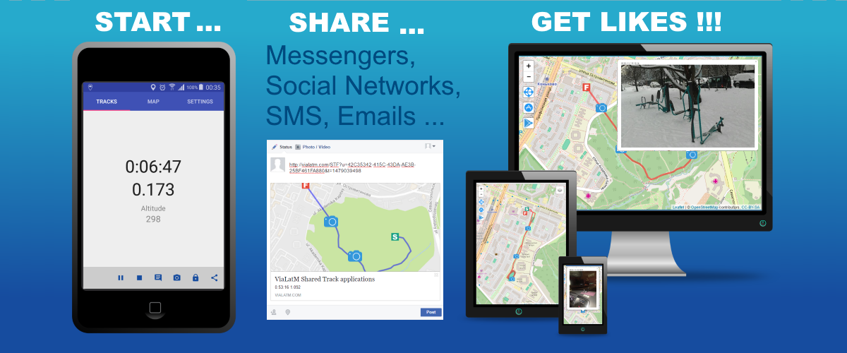
If the track is active and you have opened access to it, observers (via a link in any browser) see your movement and photos taken in real time (image below, on the right).
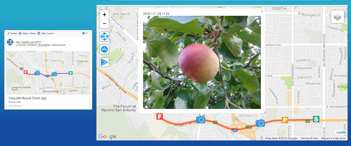
You can share the link to the track directly from the application through various channels: instant messengers (WhatsApp, Viber, ...), email, sms and social networks. Many channels allow you to display the link in the form of a mini map with the display of photo markers (image below, on the left).
Use cases
When someone is waiting for your arrival, you can launch the application and send a link to your transfer to the waiting person. The person waiting will see your current location and real-time movement track.
When loved ones worry how you get to a certain place, you can send them a link. They will see where you are now and how long you have to get.
When you come across something interesting, you can start the application, wait for the fixation of coordinates and take a photo. It will be tied to the location on the map.
When you organize a meeting, you can use the “Shared Track” to create a route to the place of the appointed meeting, provide it with photo landmarks and send to the participants.
Features and Differences from My Location Companion
The application differs from the My Location Companion application (integrated with ViaLatM service) in simplicity. Immediately after downloading it, you can start tracking and share it with observers using a minimal set of actions.
Photos can be taken with a standard camera, which does not require unlocking the smartphone. After completing the track, you can add these photos to the track. If it is public, then they will be immediately transferred to the server and available to observers.
The application tries to save battery, in the settings the minimum interval for fixing the distance is 10 meters. The larger the interval, the more economical the battery is consumed, but the track may be displayed “angularly”.
In places where there is no GPS (metro, shops, ...), you can temporarily pause tracking. However, the application does not consume battery.
Data for open access tracks is stored on the server. When you delete a track on a smartphone or block access to it, all data from the server (including photos) is automatically deleted.
Application screenshots

Similar applications
If you know or use another application for such purposes, please inform about it (them) in the comments or directly by email to support@vialatm.com. In the next article, a comparative analysis of such applications is planned and I will definitely consider your candidates.
Further development of the application
The application is actively developing. There are many ideas for improvements. I would like to hear an opinion which of the following functions you would like to see first of all (or write your requirements):
Only registered users can participate in the survey. Please come in.
Priority improvements for the next version
- 66.6% Downloading and following a track created by other users 10
- 46.6% Download nearby attractions, display them on a map with the ability to view photos 7
- 53.3% The task of geofences (s), upon entering which, tracking automatically stops 8
- 66.6% Auto pause tracking if GPS tracking is not fixed for a long time 10