GPS control for personal use (Part 2. System overview)
In this part of the article I will consider two Russian and one Belarusian system.
The choice was made according to the criteria: they are applicable for personal use, are free and can work with tracking applications on smartphones (for each system, an application on smartphones with OS Android, created within the framework of the company’s developer, is considered).
All systems provide access through browsers of mobile devices (not just opening the same page as for notebook / desktop browsers, but with changing the layout of the screen for small resolutions).
All considered systems have their own (developed within the framework of the companies) telematic servers. For all, they can be installed on the customer server. To clarify specific conditions, you must contact the developer. The important questions are: what resources will be required for this, how easy it is to maintain the system, and how the update process is organized.
There are many more systems on the market, but the ones chosen are certainly worth considering when choosing tools for personal monitoring.
Perhaps some important points from the point of view of system developers or users I missed. I hope they appear in the comments.
The system developer company has been working in the telematics market since 2005.
Applications for personal monitoring: childcare; help for the elderly; care for novice drivers; outdoor activities, tourism, sports.
The line of devices that are connected to the system is quite wide and also includes devices of their own production (which makes it possible to effectively integrate them into the system).
In addition to GPS / GLONASS monitoring, the system has the ability to work with GSM cameras, which in my opinion is also interesting in the field of personal use.
Large corporate clients are also offered the option when the software distribution is installed on the organization’s server.
Free Rate Restrictions: up to 2 objects; history for 1 day; 3 maps of Russia and the world. The free tariff plan is available only for trackers (it has become unavailable for mobile applications).
Key features:
The monitoring system has been developed by GlobalSat LLC specialists since 2007.
Fields of application for personal monitoring: monitoring and ensuring the safety of children, the elderly, relatives and friends.
In addition to GlobalSat devices, dozens of different GLONASS / GPS trackers from other manufacturers can be connected to the system, including the popular Falcom Stepp, Enfora, Xexun, Teltonika and others.
GS Monitoring Online is a professional platform for organizing your own monitoring service. GS Monitoring Online is used by dozens of successful companies in Russia and foreign countries, offering GLONASS / GPS monitoring services under their own brands.
Free Rate Restrictions: up to 3 objects; history for 1 day; no control over visits to geofences; There are no operational alerts about events via email or SMS.
Key features:

Established: 2007 (but if you take into account that this is a product of Gurtam, we can assume that the system has been developed since 2002).
A simple and convenient system for personal monitoring: control and safety of children and relatives. Allows you to capture and share events with friends (including through social networks).
The company does not supply its devices, but the list of devices with which the system can work significantly exceeds all existing systems.
Gurtam has developed a new Wialon Local service product, a GPS and GLONASS monitoring system that can be installed on customers' servers.
Limitations: in one account, you can connect up to 5 monitoring objects (one car and four personal trackers); 1 month history maximum 20 geofences per account.
Key features:
Settings
View incoming / outgoing messages; delete messages; sending images and states.
Statistics and status The
current status of the service; Recent localization data statistics of sending messages.
Map
Displays the current location on a map with the date, speed, altitude, and location error.
In the next part of the article, I will consider several foreign applications, and in the final part I will talk about using our ViaLatM system for personal monitoring.
The choice was made according to the criteria: they are applicable for personal use, are free and can work with tracking applications on smartphones (for each system, an application on smartphones with OS Android, created within the framework of the company’s developer, is considered).
All systems provide access through browsers of mobile devices (not just opening the same page as for notebook / desktop browsers, but with changing the layout of the screen for small resolutions).
All considered systems have their own (developed within the framework of the companies) telematic servers. For all, they can be installed on the customer server. To clarify specific conditions, you must contact the developer. The important questions are: what resources will be required for this, how easy it is to maintain the system, and how the update process is organized.
There are many more systems on the market, but the ones chosen are certainly worth considering when choosing tools for personal monitoring.
Perhaps some important points from the point of view of system developers or users I missed. I hope they appear in the comments.
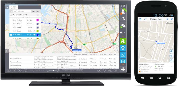
WHERE MY MY http://www.gdemoi.ru/ (Russia)
The system developer company has been working in the telematics market since 2005.
Applications for personal monitoring: childcare; help for the elderly; care for novice drivers; outdoor activities, tourism, sports.
The line of devices that are connected to the system is quite wide and also includes devices of their own production (which makes it possible to effectively integrate them into the system).
In addition to GPS / GLONASS monitoring, the system has the ability to work with GSM cameras, which in my opinion is also interesting in the field of personal use.
Large corporate clients are also offered the option when the software distribution is installed on the organization’s server.
Free Rate Restrictions: up to 2 objects; history for 1 day; 3 maps of Russia and the world. The free tariff plan is available only for trackers (it has become unavailable for mobile applications).
Useful features of the system
- Cartography: 3 providers (out of 10 possible); road traffic (Yandex, ProGorod, Google).
- Search for a location on a map by address. Geocoder can be selected (Yandex, ProGorod, Google, OpenStreetMap).
- Geofences: circle, polygon, route. The route is laid instantly. At the same time, the corridor specified at its creation (along the radius) is displayed.
- Geofences: convenient editing, deletion and display on the map of marked geofences.
- Ability to display a mini-map.
- You can add custom layers to the map (in KML format).
- The list of objects is easily displayed / hidden on the screen. Having selected an object in the list, you can see trips and events on it for a certain time interval. An icon for its status is displayed for each object in the list.
- When you click on an event selected from the list, the location of this event on the map is displayed.
- Icons of objects on the map change depending on the state.
- If the information panel is open (at the bottom of the screen), then when you click on the name of the object on the map (or on the object in the list), it displays detailed information about the state of the object.
- The information panel of the object consists of widgets. If all widgets do not fit the width of the screen, they can be scrolled left and right, swapped (by dragging the mouse) and hide.
- You can simultaneously display on the map several tracks from one or different objects. For each track, speed, mileage and travel time are available directly on the map.
- A well-developed system of alert rules. Alert rules can be created for various types of events: start / end of the trip; Entry / exit from the geofence; over speed; deviation control from the route; alarm button; low battery; shutdown or loss of connection with the object and others. The rules set event parameters (permissible speed, battery charge, ...), text and channel (SMS, email) alerts, time schedules (by hours and days of the week) and geofences in which alerts should be generated for these events.
- You can contact technical support directly from the application.
Smartphone application “NAVIXY Android GPS Tracker”
Key features:
- Setting the time and distance, after which a location record is formed.
- The mode of saving gprs traffic. Setting the data transfer mode: continuously or at certain intervals.
- The ability to configure the address of the server to which the transfer is being made.
- Battery saver mode: Sets the interval to turn on the GPS receiver.
- Setting the application widget: show the current state of the application or, when clicked, start / stop tracking.
- Display of technical information - the number of points not sent.
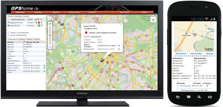
GPSHome http://www.gpshome.ru/ (Russia)
The monitoring system has been developed by GlobalSat LLC specialists since 2007.
Fields of application for personal monitoring: monitoring and ensuring the safety of children, the elderly, relatives and friends.
In addition to GlobalSat devices, dozens of different GLONASS / GPS trackers from other manufacturers can be connected to the system, including the popular Falcom Stepp, Enfora, Xexun, Teltonika and others.
GS Monitoring Online is a professional platform for organizing your own monitoring service. GS Monitoring Online is used by dozens of successful companies in Russia and foreign countries, offering GLONASS / GPS monitoring services under their own brands.
Free Rate Restrictions: up to 3 objects; history for 1 day; no control over visits to geofences; There are no operational alerts about events via email or SMS.
Useful features of the system
- Cartography: Yandex, Google, OpenStreetMap; road traffic (Yandex, Google).
- Geofences: polygon.
- Geofences: convenient editing, deleting, changing colors, displaying marked geofences on the map.
- A handy tool for adding your own POIs (Landmarks). Nice set of icons. This is a kind of round geofence, with a given radius and an icon in the center.
- The list of objects is easily displayed / hidden on the screen. Having selected an object in the list, you can quickly look at it history, trips and events for a certain time interval. For each object in the list, the battery charge and its status icon are displayed.
- When you click on an event selected from the list, the location of this event on the map is displayed.
- When you click on an object in the list (or on the icon of the object on the map), it is centered on the map and an information window opens for it. Directly in it, you can choose a short or detailed mode of displaying information.
- For each track, speed, mileage and travel time are available directly on the map. Tracks can be exported to KML, GPX.
- An advanced alert rule system is available. Alert rules can be created for various types of events: SOS; control of entry and exit from geofences; battery level control; overspeed control and others. The rules set event parameters (allowable speed, battery charge, ...) text and channel (SMS, email) alerts.
- You can create additional users (operators) for the account. They can monitor objects and receive reports, but do not have administrative access to their personal account.
Smartphone application “GPShome Tracker (beta)”
Key features:
- Displays the location of the smartphone on the map with data on the current position and accuracy of coordinates.
- Set the frequency of sending location reports during parking.
- Set the frequency of sending location reports when driving.
- Prohibition / permission to use GPS localization.
- Prohibition / permission to use Network localization.
- Prohibition to turn off the GPS receiver if the speed is above the set threshold.
- GPS search time. Setting the interval after which the GPS receiver turns off if the position has not been determined.
- Setting the sensitivity of the motion detector.
- Generating an application operation log to send information to the developer (if errors are detected).
GPS-Trace Orange http://gps-trace.com/ (Belarus)
Established: 2007 (but if you take into account that this is a product of Gurtam, we can assume that the system has been developed since 2002).
A simple and convenient system for personal monitoring: control and safety of children and relatives. Allows you to capture and share events with friends (including through social networks).
The company does not supply its devices, but the list of devices with which the system can work significantly exceeds all existing systems.
Gurtam has developed a new Wialon Local service product, a GPS and GLONASS monitoring system that can be installed on customers' servers.
Limitations: in one account, you can connect up to 5 monitoring objects (one car and four personal trackers); 1 month history maximum 20 geofences per account.
Useful features of the system
- Cartography: Yandex, OpenStreetMap, Gurtam Maps, Virtual Earth; road traffic (Yandex).
- Search for a location on a map by address.
- Geofences: circle, polygon, broken line.
- Geofences: convenient editing, deleting, color changing.
- Button for fast transition to the maximum map scale.
- A list of objects is displayed in the bottom line of the screen. On the left are personal trackers, on the right are car trackers.
- When you double-click on the name of the object (in the bottom line of the screen), the information panel of the object appears at the bottom of the screen.
- In the information panel, you can edit the parameters of the object. You can change the icon, device type, imei and sim card. Here, the object can be deleted from your account.
- In the object panel, you can configure the display modes of the tracks and request a report on the tracks. A convenient tool for playing a track. For each track, when you hover over its points, the address, time and speed are displayed.
- In the object panel, you can configure notifications about events related to speeding, geofences, communication with the device and the panic button. Notifications are sent to the specified email.
- At the bottom of the screen, you can show / hide the panel with the current stream of messages from objects. The user’s operations for editing information and object parameters are also recorded there.
- Each object can be fixed (follow the object). At the same time, when messages arrive, the map will be scaled so that the object is visible.
- A button is available to switch to displaying the application in full screen.
Smartphone application “GPS Tag Orange”
Key features:
Settings
- Service operation mode: operation mode constantly or by timeout; control of work in roaming; autostart after reboot; work when connected to charging; Scheduled service mode.
- Connect to server: control the connection to the server to receive incoming messages.
- Object settings: set the password for the object.
- Location: select a GPS and / or Network location provider; enable message filtering for sending; min time interval; Min distance course change; speed difference; Max. error; maximum speed.
- Message settings: expanding the transmitted message parameters: provider, accuracy, charge level; setting up states and statuses.
- Notifications and status: select notification types; tracking notifications with signals; setting the display mode of the service in the notification panel of the smartphone.
- Others: camera; units; administrator password and other settings.
View incoming / outgoing messages; delete messages; sending images and states.
Statistics and status The
current status of the service; Recent localization data statistics of sending messages.
Map
Displays the current location on a map with the date, speed, altitude, and location error.
In the next part of the article, I will consider several foreign applications, and in the final part I will talk about using our ViaLatM system for personal monitoring.