2GIS added 3D models to maps
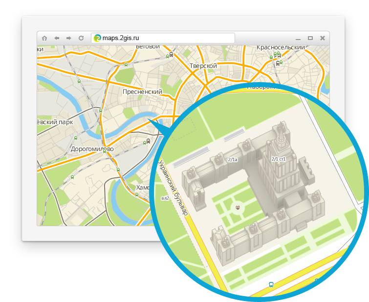
This spring, the good old 2GIS for PC underwent a significant change - the transfer of the map to a new engine made the cities truly three-dimensional. Now 3D has appeared not only in other products - the map API and 2GIS online - but also got the details. We painted the brightest buildings in 34 cities.
What are these buildings, how many of them, how they look and what needs to be done so that we draw your cottage ...
3D, of course, is better to watch than read, so we made a video:
References:
References:
- See models in action in a special 2GIS mode online.
- Use our 3D maps on your sites using APIs and widgets .
- Download 2GIS for PC , where models can not only be viewed, but also rotated.
(Habr users will appreciate the flight between the models withCtrl+[andCtrl+]) - Vote for the buildings of your city , for which we will draw the following models.