Mars - even more ice near the north pole, but deep
A new study, based on the analysis of data from the SHARAD radar (installed on the MRO apparatus (Mars Reconnaissance Orbiter)), showed interesting results - vast layers of ice and sand (containing up to 90% water) were found at a depth of more than one and a half kilometers below the surface of Mars in the vicinity of northern poles, and their volume is enough to cover the entire red planet with a layer of water at least 1.5 meters deep, making it a little bluish.
In continuation of this publication, “How Mars Loses Water - A Scientific Study with Modeling . ”
A new scientific work, “Ice and Sand Caps Buried Under the Surface at the North Pole of Mars,” was published in the journal Geophysical Research Letters.

In this study, scientists from the University of Texas and Arizona (USA) used data obtained from the SHARAD subsurface radar (Mars SHAllow RADar sounder), installed on board the NASA MRO (Mars Reconnaissance Orbiter) spacecraft.
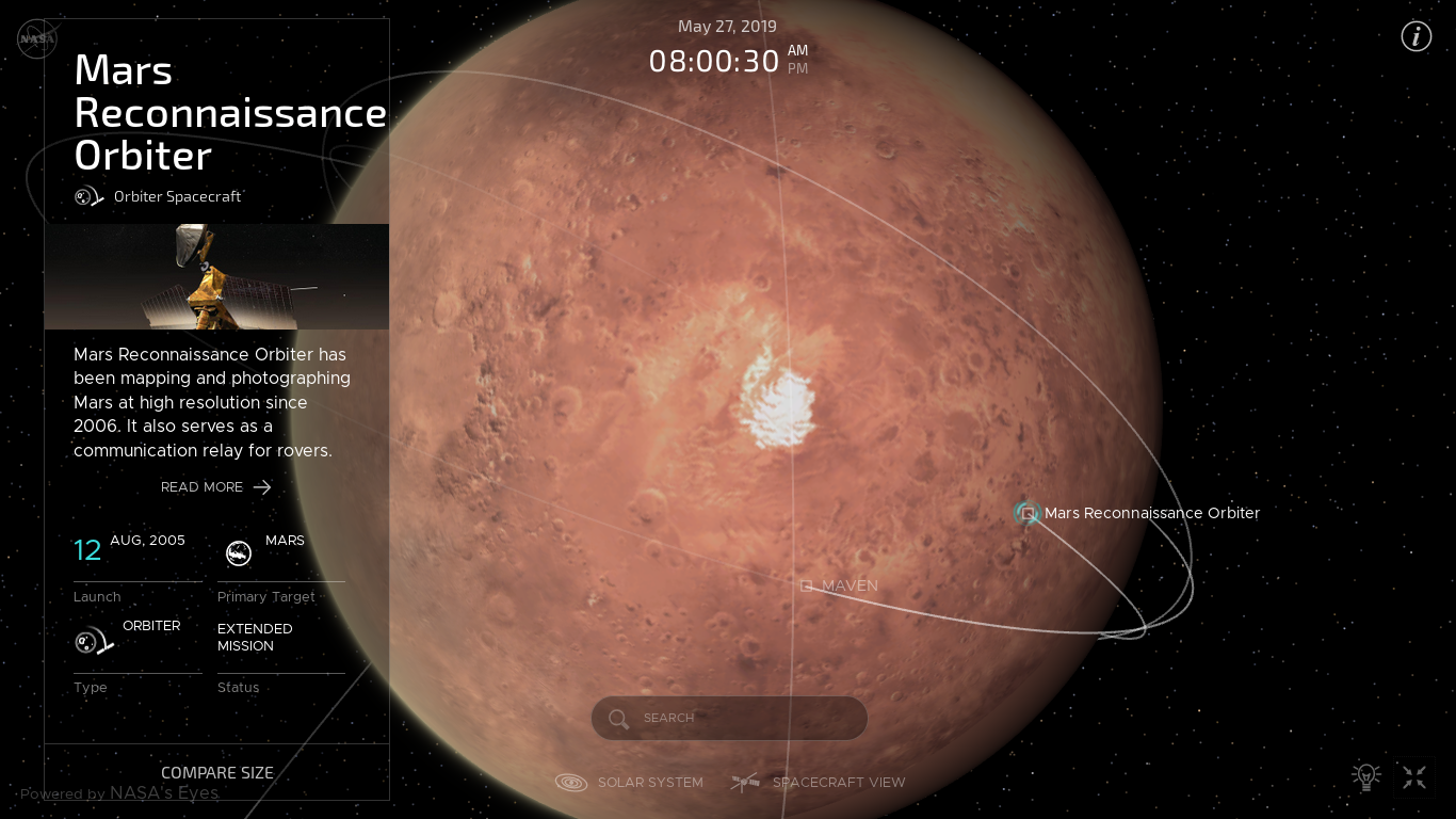
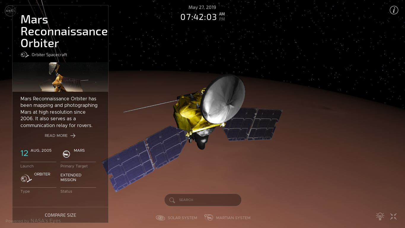
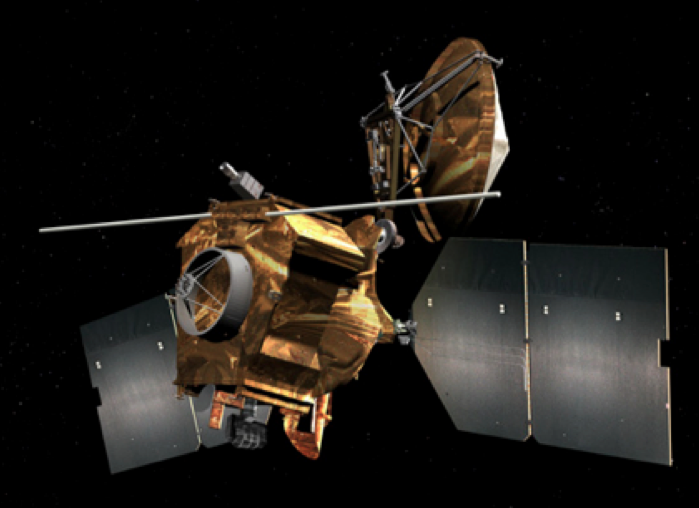
The Mars Reconnaissance Orbiter (MRO) was launched on August 12, 2005, reached Mars on March 10, 2006, and in November 2006 began full-fledged scientific research after the end of orbital maneuvers, checks and calibrations of onboard equipment.
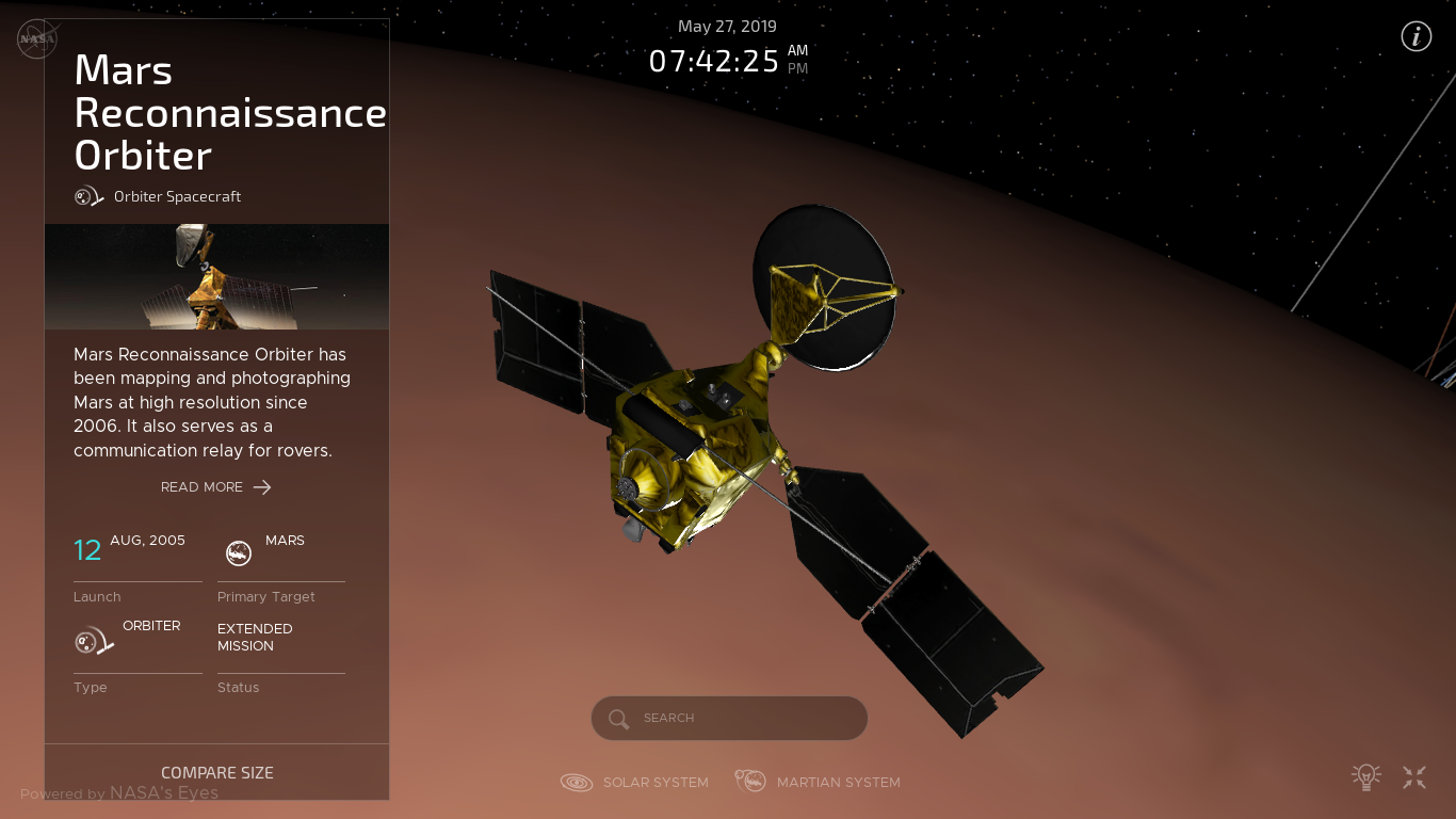
MRO contains a number of scientific instruments, such as cameras, spectrometers, radars, which are used to analyze topography, stratigraphy, minerals and ice on Mars.
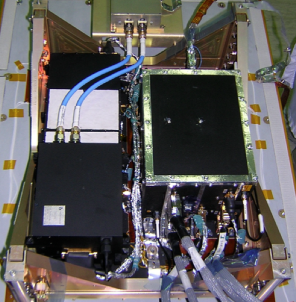
The SHARAD radar is installed on the MRO to study the internal structure of Martian polar caps, as well as collect data on underground ice deposits.
An external radar antenna is a separate unit on the MRO.
The SHARAD radar uses high-frequency radio waves in the range of 15-25 MHz, which allows it to probe the surface to a depth of 7 m to 1 km. Horizontal resolution is based on 0.3 to 3 km (0.3–1 km along-track and 3–6 km across-track). The pulse duration is 85 μs, and the nominal pulse repetition frequency is 700.28 Hz, the transmitted power is 10 W, a ten-meter dipole antenna is used for measurements.
The sounding method is radar synthesis of the aperture, which allows you to obtain radar images of the Martian surface and the objects located on it, regardless of meteorological conditions and the level of natural illumination of the area with a detail comparable to aerial photographs.
To expand the capabilities of the radar, scientists use SHARAD paired with the MARSIS radar, which has a lower resolution, but is able to probe the surface to a depth of 5 km. MARSIS is installed on another currently operating spacecraft - Mars Express.
In their new scientific work, scientists showed that they discovered the remains of ancient ice sheets lying below the surface at the north pole of the planet at a depth of more than one and a half kilometers, which proves the existence of periods of growth and depletion of polar ice on Mars associated with a change in its orbit and inclination.
The results are important, because the ice layers on Mars are a kind of annual rings, keeping records of the climate on it in the past. A study of the geometry and composition of these layers can tell us whether there were ever favorable conditions for the emergence of life.
How did these underground layers form?
The process of ice accumulation at the poles of the planet occurred during the last ice ages.
Further, when the planet began to heat up, the remains of the ice caps were covered with sand, which protected the ice from sunlight and prevented it from escaping into the atmosphere, and then into outer space.

With a period of approximately 50,000 years, Mars leans toward the Sun, and then gradually returns to a vertical position, like an oscillating top.
When Mars rotates in an upright position, its equator is facing the Sun, which causes the growth of polar ice caps. As Mars changes its slope, ice at the poles is covered with layers of sand, so that alternating layers of ice and sand are not very deep below the planet’s surface in the vicinity of the poles.
These findings are of great importance because ice layers reflect ancient climate changes on Mars, similar to how tree rings reflect changes in the ancient climate on Earth.
Abbreviations used in the pictures below:
- layered deposits at the north pole - north polar layered deposits (NPLD);
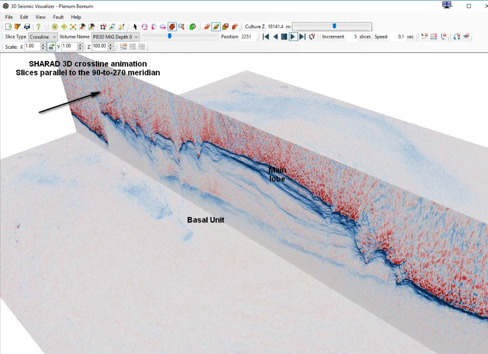
- Basal unit (BU);
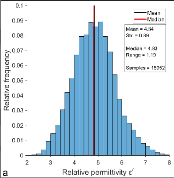
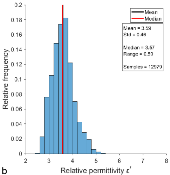
- dielectric constant ε '(ε' = 8.8 for sand, ε '= 3.1 for ice);
- rocks (Rupes);
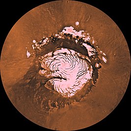
- The North Plateau (Planum Boreum) is a plain located at the north pole of Mars.
Data and graphs from the research work:
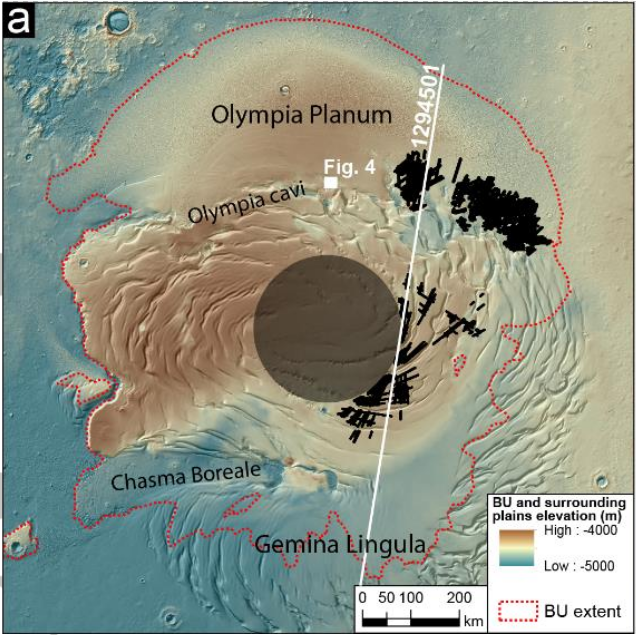
Figure 1. Place of research
A: Map of the elevations of the North Plateau and surrounding plains with relief (black bars - places of detection of subsurface cavities with ice layers):
B: Measurement of dielectric constant in the areas of subsurface cavities:

C: Schematic representation of the stratigraphic divisions of the North Plateau:
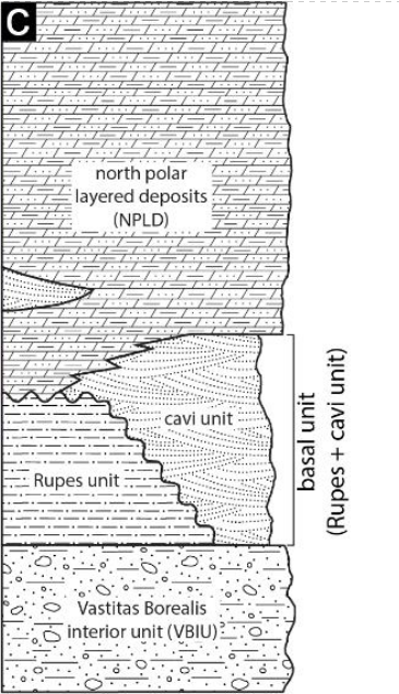
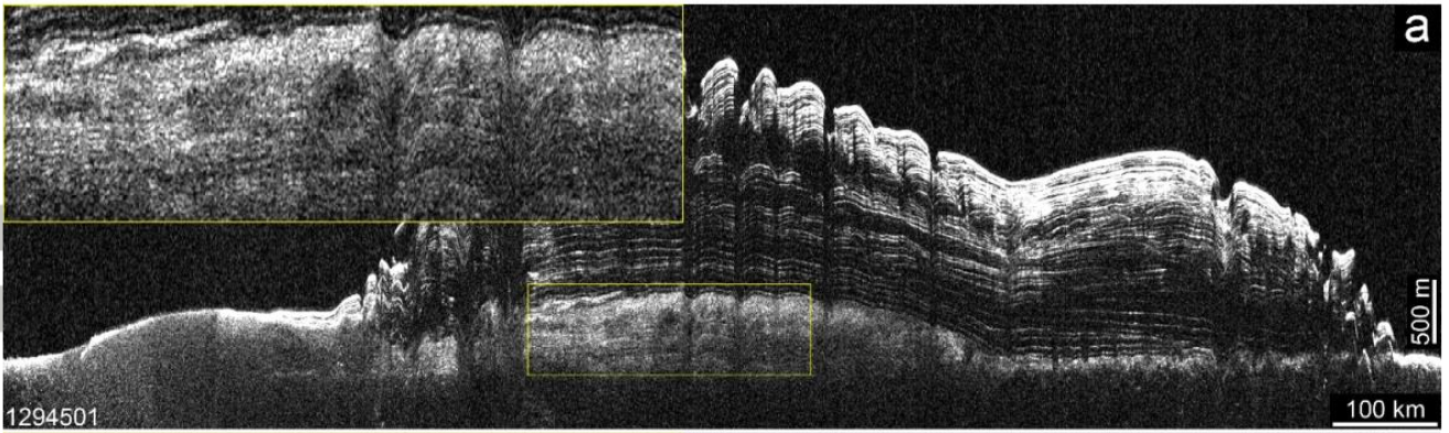
Figure 2. Data from the SHARAD radar
A: Original slice image from SHARAD:
B: Interpreted slice image, in which times are highlighted internal layers (dielectric constant data were analyzed):
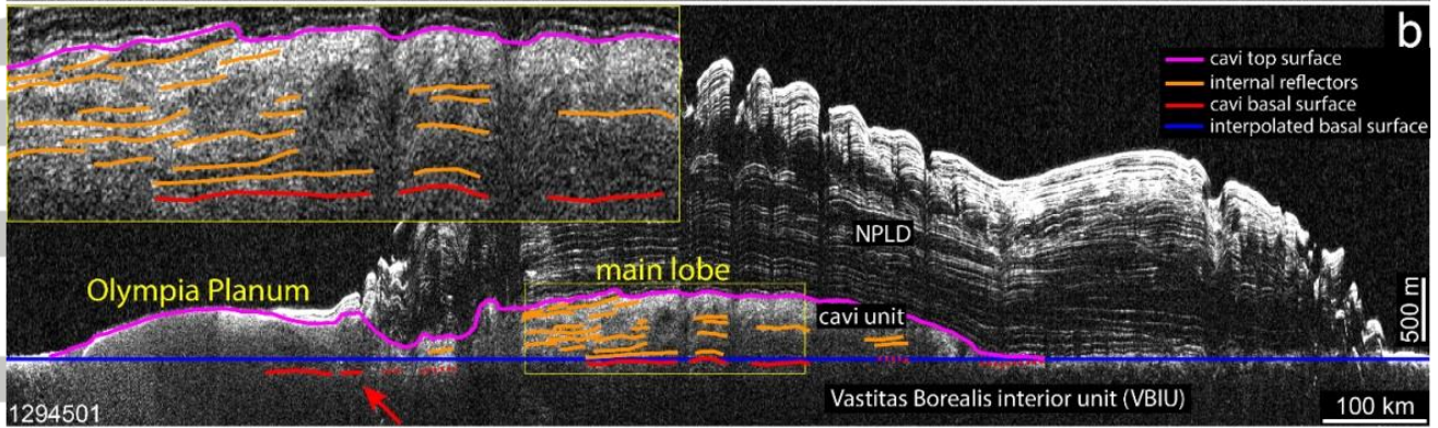
Figure 3. Statistical data for the analysis of calculations of the relative permittivity of samples .
A: averaged over the entire plain of the North Plateau:
B: in the central part of the plain of the North Plateau:
C: generalized Basalt-Gypsum Ice diagram for the North Plateau:
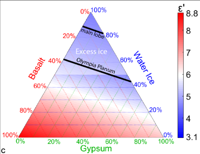
Figure 4. Computer model of the structure of the cavities of the North Plateau at a depth of more than 1,500 meters (blue color - ice, orange lines - sand).
It can be seen that in the central part below the surface, the ice deposits are very extensive:
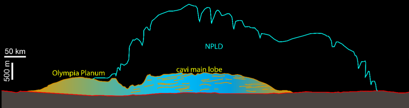
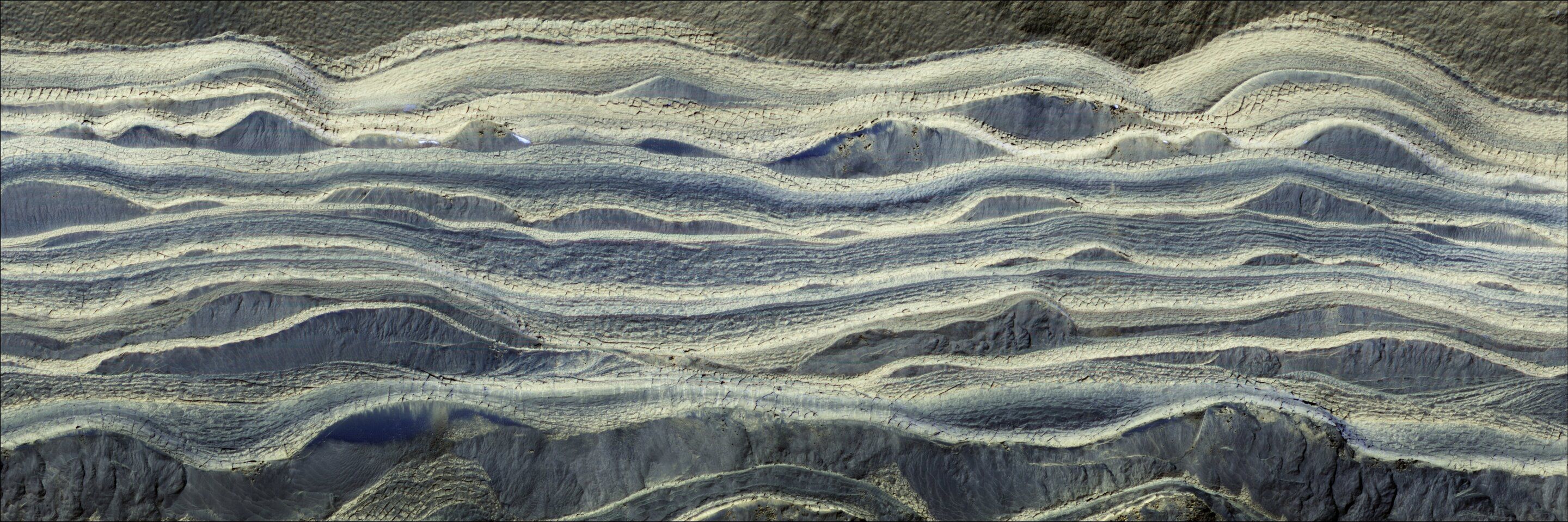
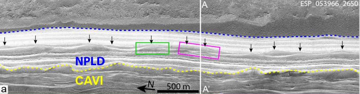
Figure 5. Analysis of one of the samples of a slice of subsurface cavities of the Northern Plateau.
A: Slice pattern with steep ledges and dunes inside (black arrows):
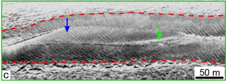
C:Green section in magnification (blue arrows - layers of sand, green - cavities with ice):
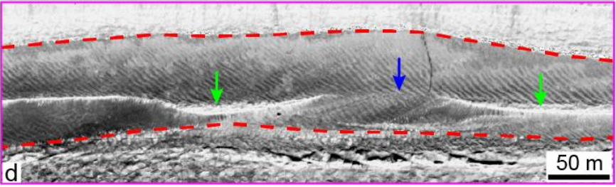
D: Purple section in magnification (blue arrows - layers of sand, green - cavities with ice):
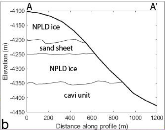
B: Topographic profile of the studied section:
Thus, further By studying and analyzing about 3,000 different samples similar to those described above, subsurface layers of sand and ice containing up to 90% water (from 62% to 88%) were discovered, and these are ancient ice caps that survived beneath the surface of Mars and are waiting for their further study .
To organize water production on Mars, it is very important to understand what its reserves in the past were available on the planet on a global scale, and what part of it could be preserved in its polar regions and how much this volume is available for extraction.
It turns out that the total volume of water in these thousand-year-old polar subsurface deposits is equal to the volume of water contained in glaciers and underlying ice layers in the lower latitudes of Mars, as well as these deposits between themselves of approximately the same age.
But water is life, therefore, understanding what volumes of water on the planet were available millions of years ago compared to how much of the water was captured and “hidden” under the poles is important, because even if on Mars there were all suitable conditions for life, but most of its water was locked at the poles, then its volume at the equator was probably not enough for the full development of living organisms.