News from the world of OpenStreetMap No. 460 (05/07/2019 - 05/05/2019)
- Transfer
openSenseMap - a platform for publishing sensor data 1 | senseBox Institute for Geoinformatics, Munster, Germany; Card Data Participants OpenStreetMap, ODbL
Cards
- The Bexhill-OSM Internet portal , which contains a detailed map of the English city of Bexhill-on-Sea, has the opportunity to see pictures of interesting buildings (1300 pictures), as well as 360 panoramas, in full-screen mode. How to do this is explained in this tweet .
- The Swiss public geoportal has made available to everyone a vector map based on OSM. As Boris Meritsky notes
 (automatic translation ) in his tweet, the style of the test card can be changed, but very little.
 - On the site of the Russian OSM community ( openstreetmap.ru ) not so long ago, POIs and address information were updated.
- Dmitry Konoshonkin made a guide to Krasnoyarsk. He used OpenStreetMap as a base map.
Do you know …
- ... all the values of the tags from the "Object Life Cycle" group, with which you can indicate the current state of an object? Basically, tags from this group are used to separate already constructed and functioning objects and those that are just being designed or are under construction or, conversely, are already closed, moved or demolished. This is done so that this information is still stored in the OSM database and can be searched for.
- ... how to mark a door that opens automatically? There is a key for this
automatic_door. This information can be useful for people with disabilities, as in this way they will know that this door will open itself - without their help. - ... about this video from the
 Portuguese TVI TVI? He was sent to us by one of the users, who drew attention to the fact that it confirms the use of OSM in the authority responsible for civil defense.
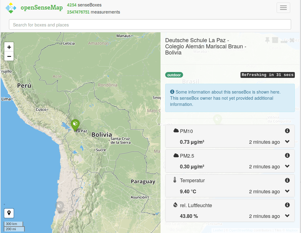
 - ... 1 about a map with open data from various OpenSenseMap sensors ? SenseBox offers students and interested citizens an OSM-based platform for collecting and publishing data from various dimensions.
OSM in the media
- On the radio "Echo of Moscow" in the program "Inside" came out an interview with Russian cartographer Nikita. In an interview, he often mentions OpenStreetMap. For example, Nikita believes that the basics of OSM should be taught in school geography classes.
- The latest issue of Map Central, a Japanese GIS technology magazine, published
 (automatic translation ) several articles about OpenStreetMap: on crisis mapping, cartography, ODbL, and more. Of course, all materials were prepared by members of the OSM community.
Other “geo” events
- Timofei Samsonov in his article ( PDF ) (co-written) talks about the automatic addition of mid contours. Software for generating the main contour lines and their calculation has been around for almost 50 years. However, the middle horizontals are drawn only where there is a place and it makes sense to show the relief. The version for ArcGIS can be found on GItHub .
- With the support of a number of large companies, the Linux Foundation has created a new foundation, the Urban Computing Foundation. It is planned that he will be engaged in the development and promotion of open source software that is somehow related to mobility.
- ZDNet talks about the project of the United Kingdom's national mapping agency, The Ordnance Survey, which aims to create a high-precision real-time map for 5G planning and autonomous driving. Data collection will be carried out by processing images taken by vehicles of utility companies, which are equipped with special cameras.
Open data
- CycleStreets wrote in a blog post about the alleged release of information on 240,000 elements of bicycle infrastructure in Greater London, published by Transport for London as open data. The article points to a newly created demo map for some areas to allow OSM mappers to evaluate the data. Please note that we are not yet allowed to use data in OSM.
Software
- CleanTechnica, a clean technology-oriented website promoting A Better Route Planner (ABRP), a router powered by OpenStreetMap data, designed for electric vehicles. The site explains why OpenStreetMap matters, and how users can start editing to improve mobility on an electric basis.
- Member geohacker from Development Seed Team is the first standalone tool for mapping fields called "Observe". Longrid is dedicated to motivation, a short user guide, plans for the future and requests to write a review.
Programs
- The release of the Leaflet library version 1.5 has been announced . If you have problems with the export module, fixing the problem with which is the only entry in the change log, then you should upgrade to 1.5.1.
- Westnordost member has released version 12 of the StreetComplete app . The new version adds a new quest "What is the name of this place?" Also added some improvements .
- Many new tests for checking OT data have recently been added to the Jungle Bus validators for JOSM (they improve the quality of public transport data in OSM):
- new tags interval, opening_hours and interval: conditional
- OT color coding
- tag differences between route_master and route relationships
- walking bus routes
- areas of bus stops and bus stations
- etc.
These validators can be enabled in the JOSM settings - Preferences> Data Validator> Attribute Checker Rules tab.
Can you help translate into your language - OsmAnd team promised to bring the version of their application for iOS to the same level as on Android. Recently released version 2.70. In a blog post in detail told about the new features. Nevertheless, you have to go a long way, since version 3.30 was published under Android in March 2019.
Mapping
- Osmose now uses MapCSS-based OpenRailwayMap design validation rules to validate rail infrastructure.
- Dr. Erin Ryan found several gaps and errors in the OpenStreetMap around Charlottesville, Virginia, while trying to geocode the arrest information. Several points indicating the prison were revealed at once, as well as the lack of the “Advanced” specification on some roads, for example, on Avon Street .
- Not so long ago, Christopher Beddow from Mapillary traveled and was lucky: he found good weather in Scotland, and therefore photographed several magnificent landscapes.
- In the golf simulator, thanks to the use of data from OSM, it is possible to accurately display the fields for this game.
- Nick Bolten wants to change the way people mark pedestrian crossings, because he believes that the existing tag is
crossing=*not entirely correct in terms of orthogonality, understanding and semantics. With his suggestion (crossing=marked), he opened a hornet's nest: this tag is already in iD, but its use is only being discussed . - Quincy Morgan, one of the developers of the online editor iD, introduced a new tag -
nonsquare=yes. He suggests using it for buildings in which some or all of the corners are not straight. The idea is to thus avoid displaying such buildings when checking for errors. Quincy Morgan was asked to discuss the introduction of this tag with the OSM community, but he ignored it. This behavior has been criticized by several users on the Talk mailing list. - TBKMrt wants to expand the range of values for the key
toll=*, which is now used only with Yes / No values in 98.98% of cases. He suggests complicating the look of the key to where the valuestoll=: can be: fee (fee), vignette (toll road), meter (parking meter ) or no (no). The key toll:type=can also be used with distance or time .
switch2OSM
- OpenStreetMap US published a link to an Associated Press article on how data from the US Census Bureau, Cal Fire, and OpenStreetMap were combined to evaluate escape routes during fires.
Community
- Osmer from Germany dktue inquired (automatic translation ) in the Austrian Talk newsletter why postal codes are not marked throughout Austria, as is done in Germany. During the discussion, it turned out that he was talking about the designation of postal codes by drawing multipolygons, which cannot be so easily implemented in Austria, since the necessary data are missing.
- The well-known Russian osmer Ilya Zverev began to release a podcast about GIS technologies - "Kartokalipsis" (in Russian). In each issue, he, Sergey Golubev, and Maxim Dubinin ( NextGIS CEO ) discuss one specific topic related to GIS. In the penultimate issue, called OpenStreetMap Kills , they talked about the negative impact of OSM.
- alexkemp studied the spam stream (30 thousand messages per day), which appeared in OSM diaries from the end of April. In his blog, he talks in detail about his proposed rule " no edits - no diary " that can stop spammers.
OpenStreetMap Foundation
- The German branch of FOSSGIS received applications for grants from the developers of OpenLayers
 (automatic translation ) and Overpass (automatic translation ). The first ones want to receive funding for a five-day programming marathon, within the framework of which the existing errors in their open Javascript library would be eliminated, as well as work was done to accelerate and simplify it. Second, we would like to update the Overpass development server, which now runs on a computer five years ago.
 - The minutes of the meeting of the working group on licenses dated April 11 were published .
- At the end of May, the OSMF Council will meet in person in Brussels, and therefore already now it has begun collecting topics and issues that, in the community’s opinion, should be considered at this meeting. You can send them through a specially created questionnaire for this .
- A year ago, the Open Source Initiative , with which the Linux Foundation , Python Software Foundation , Wikimedia Foundation, and many others also collaborated , invited OSM to become its partner. The OSMF Council agreed.
Events
- FOSS4G Hokkaido 2019 website is open (automatic translation ). The meeting will be held in Sapporo on July 12 and 13. Applications for reports and seminar topics will be accepted until May 24.
Humanitarian OSM
- Mapillary and HOT are collaborating to speed up the collection of map data in low-map regions with the launch of the # map2020 campaign. They ask local cartographers to provide street pictures; this data is needed for humanitarian purposes. The two winners will be invited to the HOT Summit in Heidelberg, Germany, in September this year.
The communication of Russian OpenStreetMap participants goes in telegram chat and on the forum .
There are groups on social networks VKontakte , Facebook , they mainly publish news.
Join now!