How we lost and found cars in a 9-story parking lot
In our office there are 9 floors of parking, each floor is 40 by 60 meters. A common problem is that employees forget the floor with their car and how zombies walk with keys, trying to “pop” the alarm. It was there that we decided to run in Bluetooth-based indoor navigation.
In general, the topic is hot. Big shops (grocery carts with push notifications about promotions and interesting products nearby), stadiums, airports and state-owned companies for all kinds of indoor navigation have an active interest. There was an experience for museums, but a number of things needed tests. And solutions are relevant for industry (monitoring personnel, cargo, transport; ensuring industrial safety and labor protection).
About the sensors themselves have written hundreds of times. I want to talk about the practice of their application in the real world. For example, one of the surprises during the tests was that they fall on people's heads.

Introductory
Initially, they wanted to solve the problem using video analytics of numbers (we have an RFID pass at the entrance to the building and recognition of numbers before entering the territory), but the roads are dirty in autumn and spring, so video analytics disappears. Painted the doors on different floors of the parking lot in different colors - it did not help. They stylized each floor for their country and wrote the name - it did not help. The result - sets of bluetooth sensors. At the same time, they wanted to check out other indoor navigation applications.
The problem is solved by choosing the right sensors (the right technology and implementation) and writing the right application. With the office navigation app, the idea with cars is pretty simple:
- When geofencing says that an employee is approaching the office, the iOS and Android app starts background activity. Also, the application (even iOS!) "Wakes up" if it sees beacons with a certain range of identifiers.
- At the exit from each floor of the parking lot are sensors. By bluetooth, they catch the user's phone and “see” where he went.
- While we believe that the user is walking down the stairs or taking the elevator, and not walking up and down the parking lot, that is, we remember the top floor for the interface and put the rest in the history in the log (also available, but with a lot of movements).
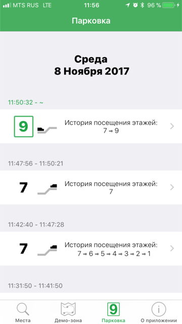
This is the “where is my car, man?” Mode. And here is the usual office navigation mode (screenshots from different versions of the software that we took during the tests, Local Geo and Navigine SDKs, Kontakt.io sensors with Rostest certificate):


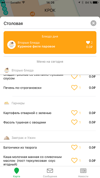
In addition to the routes and point marks “where what”, we quickly added integration with other office information sources:
Configuration
You need to place the sensors "legs" and put them on the map in admin mode:
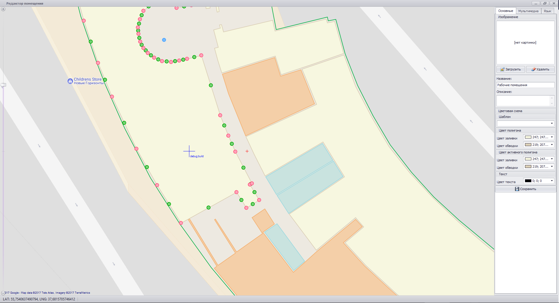
And drive the content into the database. You can still prescribe routes:

And build a lot of logic. But this is just development, and there is nothing particularly complicated there. The main thing is the convenience of arranging sensors. Fortunately, some of our models that were used for tests have NFC, which makes life very easy.
But let's talk about the hardware.
Sensors
We had different solutions from different vendors. These are probably the coolest:


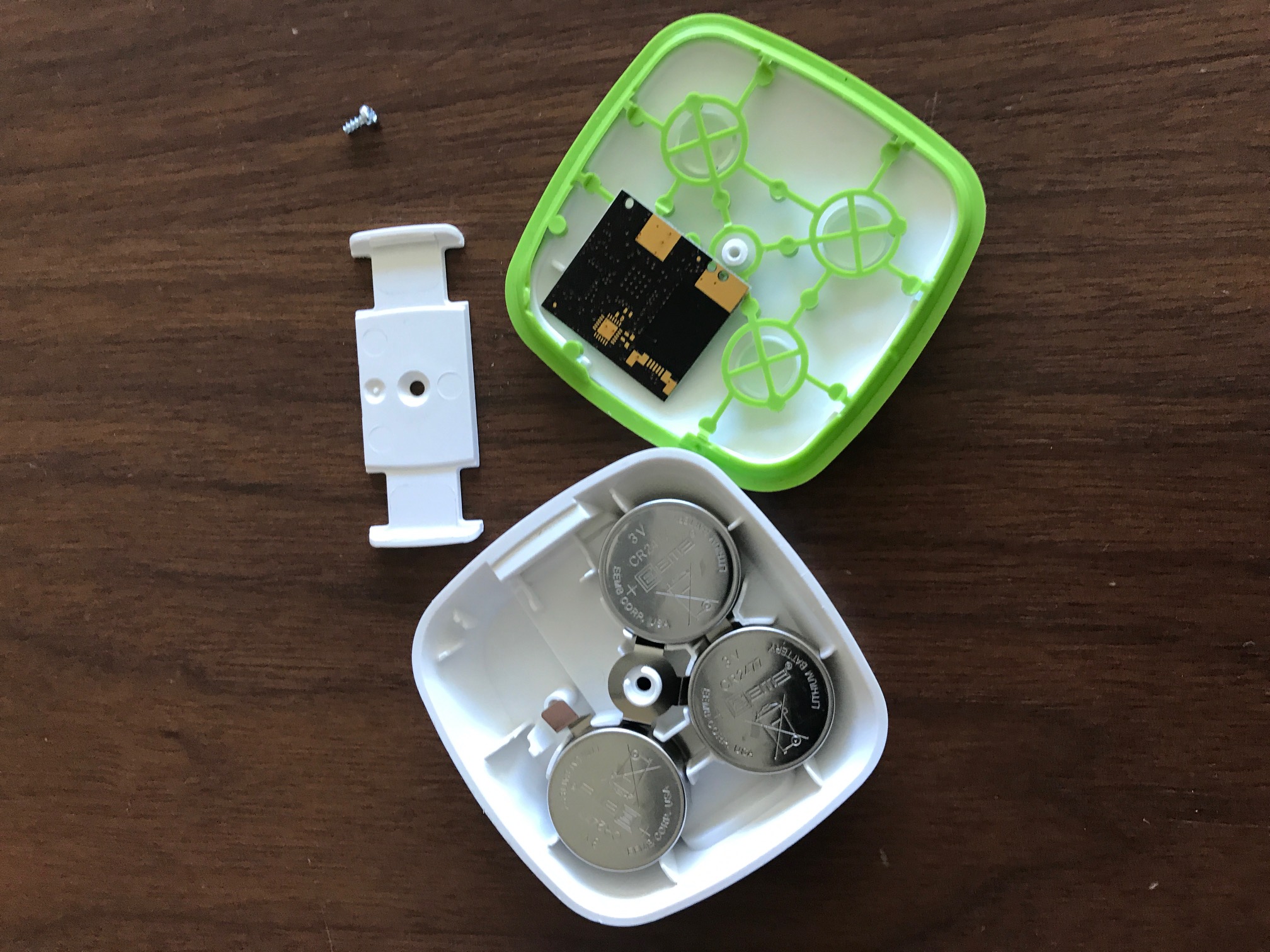
Inside:
- Three batteries (they last 3-5 years - the batteries would run out in the same time, and their life would come to an end). The same beacons are on low voltage (USB).
- A board with all the necessary things and an antenna (sends frames every 3 seconds).
- Red LED (helps when finding the right beacon during debugging and initialization).
- Light sensor (a very cool option, turns off the beacon or puts it into the mode of rare checks in the dark, that is, at night the office navigation is sleeping).
- Latch for installation, fastens to the case back with a click.
- Moisture-proof housing (can not dive, but the rain will withstand).
The sensor will be pretty bad at temperatures below -20 Celsius, so in the parking lot we put them just near the elevators or on stairways where it is relatively warm - there are radiators nearby. Here is an installation example:
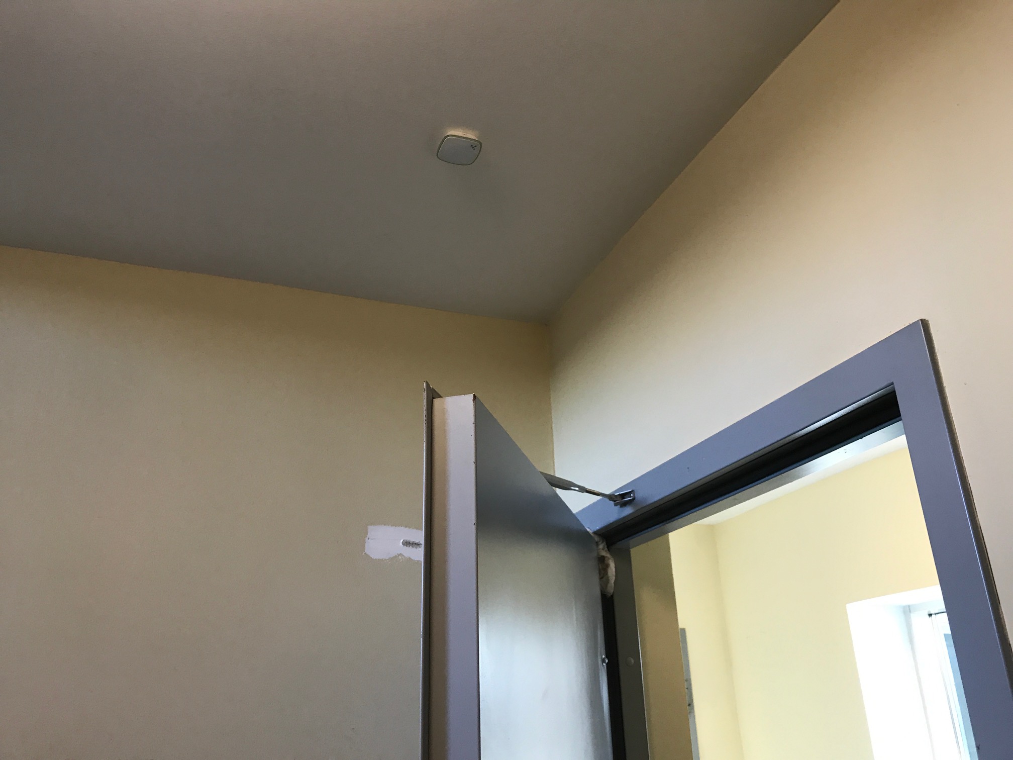
Other beacons were also tested, but these are the most impressive. Simple lighthouses (cheap) almost no surprises. Almost - this is because we fastened them to double-sided tape on the ceiling plates, and they fell after a month or two. It is best to put them on the false ceiling slabs.
Here is an installation example:
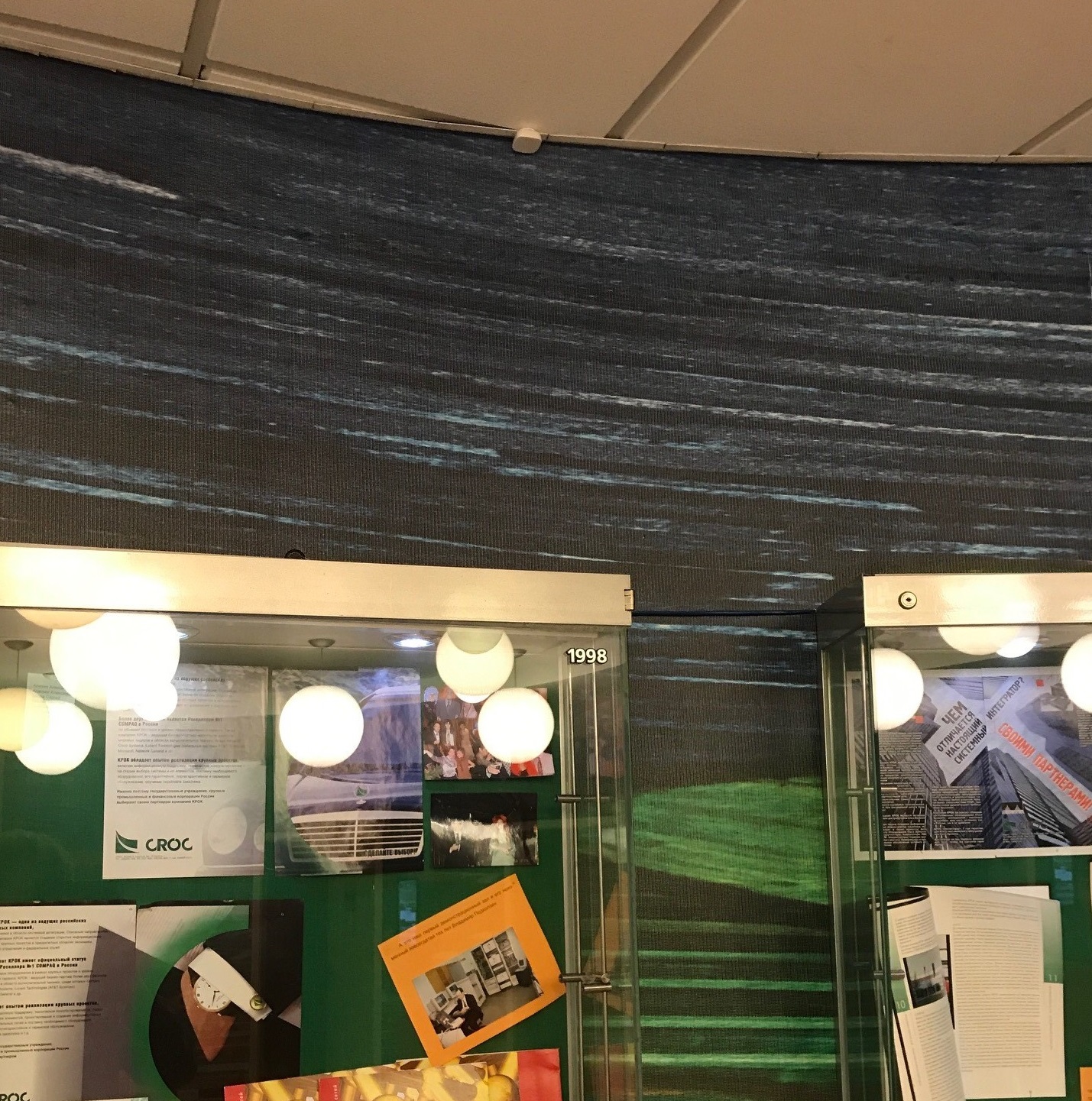
Feature: if the beacon sticks to the ceiling, it may fall on the user's head. It’s good to either stick to the false ceiling from the inside, or hang on a clip.
Summary and more details
The application is still running around in terms of working with users. More precisely, we add features: like the same dining room menu and the schedule of your own events or office bot .
In the parking lot we have Beacon Pro - 32 pieces, on the second floor of the office - just Beacon - 17 pieces.
I must say that now the Internet of things is actively developing, in particular, now there are lamps with bluetooth beacons (interesting to shopping centers) and even lamps with a bluetooth service channel to inform about the remaining resource and failures. A refrigerator, a cooler with water - all this in 5G networks will be beacons. And here is the first swallow from the Philips: here and here .
Summing up, we conclude that the use of this technology is very different - from the control of personnel at airports (who goes where) and to the features of a car dealer (some Mercedes have always disappeared on the territory). Another example: in the USA there is a large bus parking such as our car fleet, and there, before leaving the route, drivers search for their car using the same application.
Applications themselves interact with each other. Now I really want to bring vibration to the fitness bracelet in case I meet a colleague in the office a second time to know that we have already said hello. It’s a joke, of course, but overall in a large company this can be a problem.
More cases
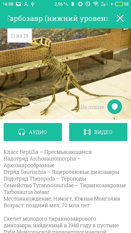
In museums, Points of Interest can be used to display data on exhibits:

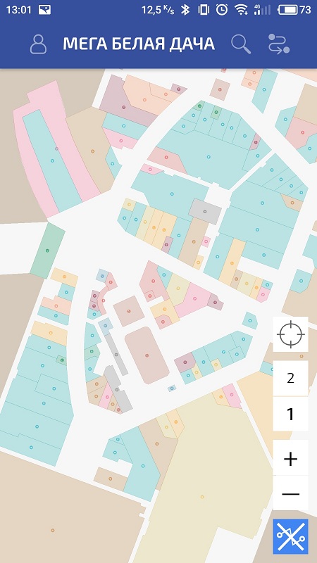
In shopping centers - to search for stores:
Well, in the stores themselves - to search for goods and push stocks if you go past the right product.
As examples from the market: Mosmetro tracks its employees (still in test operation), many stores and shopping centers in the world provide navigation services to their customers (Hamleys network, RIO shopping center, solutions - SMART carts, solutions - Shimeba for shopping centers in Israel), navigation works in many airports in Europe. Of the funniest: a year ago, the Finnish retail chain Kesko equipped its trolleys with inexpensive tablets with a store map and product information. You can type the name of the product - and the trolley will "bring" you to the place. You can also choose a recipe - and the cart will help to assemble the components. The solution itself was developed by the Finnish company Smartcart, and the navigation system was provided by the Russian Navigine. Read more on the RBC website .
In conclusion, from practice I will say that lighthouses should be hung high: paranoid engineers roam our office and sometimes remove the “iron” from the walls for analysis. And the cleaning lady once asked if this thing was now eavesdropping on her conversations.
References:
- Our application for museums .
- Wi-Fi navigation and store counters .
- Mail for questions - indoorN@croc.ru.
