Zimbabwean Patriot Spends $ 5,000 to Digitize Home Country on Google Street View
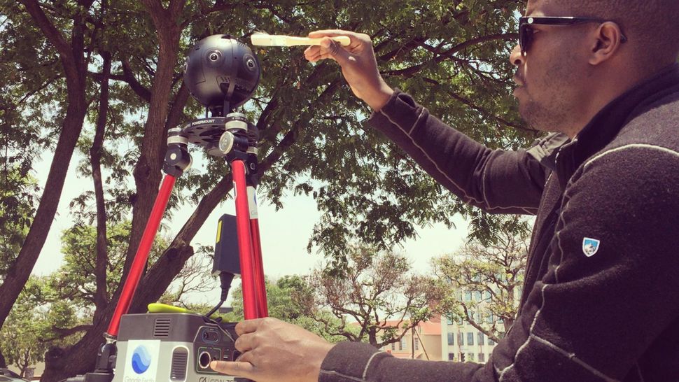
Preparing for the work of the panoramic camera Insta360 Pro 2. Photo: Tavanda Kanhem
Zimbabwe is an extremely poor African country. Although before independence in 1980, it was considered one of the most economically developed on the continent, despite the extraction of gold and diamonds, it is now among the poorest countries on the planet. Zimbabwe is a prototype of the fabulous and rich Wakanda from Marvel comics, but it doesn’t help the economy much in the real world.
It is clear that in such a poor country there are few Internet users, so the Google giant is not interested in investing money in digitizing the terrain and publishing high-quality panoramic maps. But virtual walks around Zimbabwe are still possible, and for this you need to thank not Google, but one single patriot, 37-year-old American Tawanda Kanhema, who has not forgotten about his small homeland.
Many years ago, Tawanda Kanhema left Zimbabwe to study journalism and documentary at the University of California at Berkeley. However, he recently traveled home and spent two weeks taking pictures of the sights and sounds of the most beautiful places, writes Cnet .
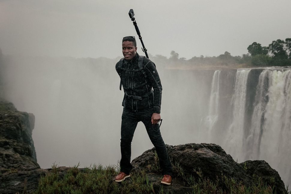
At the Victoria Falls in Zimbabwe. Photo: Tavanda Kanhem
Enthusiast digitized and laid out the central business districts of the capital city Harare on Google Street View, made a virtual tour of Victoria Falls, filmed the main avenue of Mutare and the ruins of Great Zimbabwe .
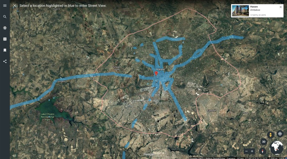
Blue areas are already digitized on Street View. Screenshot: Tawanda Kanhem
As Cnet writes, the guy used two cameras for this project: Insta360 Pro 2 and GoPro Fusion, but he especially liked Pro 2, which is out of the box compatible with Street View, that is, you can post footage directly after the shooting.
In addition to patriotism, this work directly corresponds to professional education: after all, he graduated from the university just in journalism and documentary. Shooting and virtual tours in Google Street View - this is the modern high-tech documentary.
“I started experimenting with WebVR and WebGL frameworks back in 2015,” says Tawanda Kanhem. - In 2016, I took part in Google's initiative to create custom content, using the Street View Camera program, which provides distribution of ready-made Street View cameras for photographers to shoot points of interest. Then I proposed two UNESCO World Heritage sites: Victoria Falls in Zimbabwe and Stone Town in Zanzibar as ideal pilots for expanding Street View into new markets in South Africa, a region that is still poorly represented and mostly absent from Street View. ”
Although he was given the camera for free, travel and production costs had to be paid from his own pocket. He says that he spent about $ 5000 on flights, hotel, car rental and fuel.
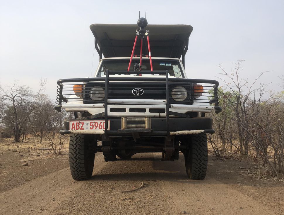
Camera Insta360 Pro 2 is installed on the ATV SUV. Photo: Tavanda Kanhem
Kanhem says that he tested about five platforms for the project, and the current setting consists of Insta360 Pro 2 and GoPro Fusion cameras. Photos from the first one are immediately laid out on Google Street View, and for the post-processing of material from the second camera, you have to use a Python script. Insta360 Pro 2 takes photos at 12K, and video - at 8K, there is a program for pasting photos, editing and publishing in Street View.
He drives a car in the cities, and for other excursions he rented another speedboat and quad bike. For Insta360 speed is limited to 60 km / h. If you move faster, the picture will be blurred. Cameras were mounted on cars and other vehicles using the CamTree Power Grip mount. The Insta360 Pro2 battery lasts for 50 minutes (of which 2–15 minutes is set up), so I had to purchase an additional GOAL Zero UPS Battery Pack battery pack, which increased the shooting time to 6 hours.
The GoPro Fusion camera was used only in rare cases, while walking on a bicycle - with a holder for the XPack GoPro backpack. She takes pictures on 6K and video on 5.7K.
In total, about 800 km of roads and a lot of sights were digitized during the project. Enthusiast is not going to stop there, and next year he intends to draw up a map of Zanzibar.