Free service with a three-dimensional map of all man-made space objects
An amusing site called StuffInSpace has come to the attention of space and space lovers . This resource visualizes man-made objects that are currently present in the Earth’s orbit - from satellites to debris of “space debris”. With the help of the resource it is clear that in the near space it is becoming cramped.
The three-dimensional representation is made using WebGL technology, and, importantly, it works quite quickly even on slow computers (I speak from my own experience). Once a day visualization data is downloaded from www.space-track.org . The site promotes the peaceful use of space and preaches a mutually beneficial exchange of information, for which a special program interface (API) is arranged on the resource.
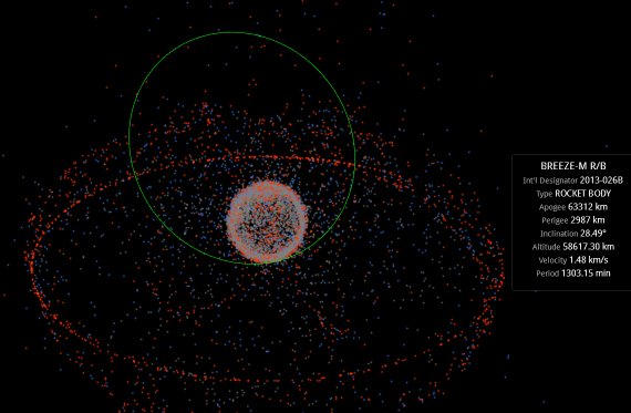
Visualization divides space objects into three types. Red dots indicate working satellites. The blue ones are rocket hulls. Gray - debris of various objects. The user can select any object with the mouse, after which the resource will show its name and current orbit, location data, speed and other data.
In a swarm of satellites you can see a clear circle of vehicles lined up exactly on the equator of the planet. It is also noticeable that with increasing latitude the density of space objects decreases.
Through the search bar you can find by the name (English) any of the objects of interest to you; The ISS, GLONASS satellites, Iridium and all other objects are presented in this comprehensive list.
The source code of the project is open and posted on github. A special satellite.js library is used to calculate the positions of satellites in space.