Nokia Maps 3D Demo (WebGL)
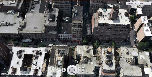
The Nokia Research Center development team has rolled out a truly amazing demo mapping service on WebGL . In addition to the beauty of the 3D model itself, the minimal CPU consumption during rendering, smooth scrolling and most of all, the ability to arbitrarily change the angle of view and rotate the model are admirable.
Perhaps in the future this project will replace the current service Nokia Maps . It is a pity that the main developer of the engine for this service, C3 Technologies, was recently swallowed by Apple, so you can’t count on extending the agreement with Nokia.
The 3D model was made by the original technology developed by C3 Technologies, using satellite photography, aerial photography at low altitude, as well as car photography, as in Google Streeview. The main innovation here is 3D photogrammetry technology, that is, remote sensing of the earth using lidars . The technology made at C3 Technologies allows you to determine the geometric, quantitative and other properties of objects on the surface of the earth from photographic images. Thus, C3 Technologies photogrammetry tools allow you to create a 3D model of the earth's surface from an array of photographs with minimal human involvement.
How was Nokia Maps 3D made
Demo of experimental technology Nokia City Scene (analogue of Google Streetview)