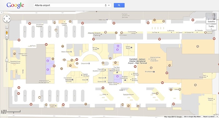
Google Maps Appears Floor Plans

A year ago, plans for some public spaces appeared in the Google Maps application for Android, but now they can be seen on the web, writes Mashable. So far, individual locations are available in Belgium, the UK, Denmark, Canada, the USA, France, Switzerland, Sweden and Japan.
Among the available premises - more than 10 thousand shops, shopping centers, airports, train stations, libraries and museums. Plans can come in handy so as not to get lost in the shopping center or to get directions from the taxi to the gate at the airport, so as not to run through the entire airport.
“Just zoom in on the building on Google Maps, and you will automatically see a detailed floor plan with useful signs for the airport gates, shops in the mall, department stores, as well as ATMs, toilets and more, ” Google writes .
Google also offers a tool that allows facility owners to add floor plans to Google Maps.
