News from the world of OpenStreetMap No. 456 (04/09/2019 - 04/04/2019)
- Transfer
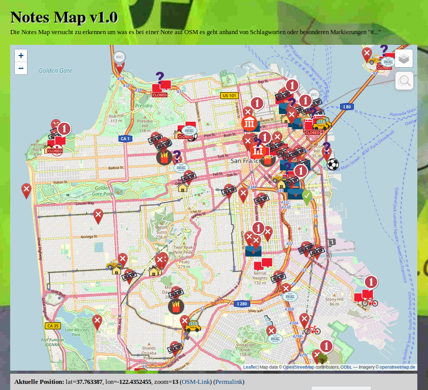
Notes Map, classifies OSM notes based on content 1 | Leaflet | Map data OpenStreetMap contributors, ODbL - Imagery openstreetmap.de
Cards
- [1] miche101 introduced the Note Map , a tool that attempts to classify notes published on the OSM website according to their content. According to his post
 (automatic translation ) on the forum, he uses a dictionary of 774 words to sort notes into 25 categories.
 - Qwant Maps got the ability to calculate the route (automatic translation ).
- Fork MapOSMatic (a tool for creating a city map and output to PDF) supported by Hartmut Holzgraefe, now uses the open source collaborative translation system Weblate instead of Transifex for localization.
Mapping
- Joseph Eisenberg has again begun the tag approval process
camp_site=camp_pitch. In fact, this tag has already been used more than 6.8 thousand times in the zonetourism=camp_siteto indicate the place for setting up a tent or motor home. - Joseph Eisenberg also suggested using a single tag instead of the existing tagging scheme for the tracks along which golf carts (
highway=pathorhighway=service+golf_cart=designated) movegolf=cartpath. - The tag
shop=fashion_accessoriesproposed by SelfishSeahorse to designate stores specializing in the sale of fashion accessories is approved. - Currently, the tag has been
place=localityused almost 1.3 million times. Its scope is wide: they refer to as ghost towns and railway junctions in the United States and territorial division in Ireland (locality=townlandandlocality=subtownland). Therefore, Joseph Eisenberg suggests using a keylocality=*to indicate the type of terrain. - Since March 15, almost all addresses in Germany, which were made in the form of relations (associatedStreet), have been redone: they were applied to buildings in the form of tags. The proportion of excess relationships decreased from 58% to 7%. The user dktue posted simple statistics about this on the forum (automatic translation ).
Software
- The database history OpenStreetMap (OSHDB) received an update. Please check for fixes and new features on GitHub.
Programming
- Users of systems that use Osmosis to get changes should check to see if their system continues to work properly, since a diff was published on April 11th that Osmosis could not handle. You can see more information on this in the mailing list .
- At the moment, the OSM API is not able to work with downloads that were sent to the API and did not receive a response, for example, due to network problems. Most clients try to download their data again, and therefore it often happens that a new object is duplicated. Mmd started a discussion of this situation on GitHub.
- In the error tracking system of the iD online editor, there is a discussion of support for tags that are part of the "Object Life Cycle" tag group. The main developer quincylvania has already implemented this in the Git branch of lifecycle-tagging .
- Muratomo said that a new version of OpenSwitchMap has been released, which now works not only with the Chrome browser , but also with Firefox . This is a browser extension that allows you to quickly open the same place on different cards and services, including OSM validators, which can be useful to any osmer. A great contribution to the development of the new version was made by the developer F4map jazzzz. Soon, the name of the project may change due to the fact that it has something in common with the OSM trademark.
Programs
- The site of the Children's card , useful to parents, has been improved .
Do you know …
- ... how to tag the name of the bridge, which is usually different from the name of the road passing through it? The corresponding tag is
bridge:name, but the road remains with the usual tagname. You can also add foreign names using a language suffix scheme such asbridge:name:ja. The same is applicable to tunnels:tunnel:name. - ... about the site laengengrad-breitengrad.de (automatic translation ) for quick geo-coordinates conversion?
Other “geo” events
- Nick Weir, in an article published on towardsdatascience.com, talks about automatic image analysis and mapping, for example, when monitoring deforestation or disaster management. The article discusses the typical problems that automated solutions face: displacement and distortion of images, lighting, occlusion of objects and resolution. According to these parameters, he considers the five best algorithms for non-sack determination of the building development spot, which were proposed as part of the SpaceNet challenge.
- The Swiss newspaper “Tagesanzeiger” published a quiz on the cities of Sweden with graphics made by “Figuregrounder” , namely Hans Hack, who used data from OSM as the basis.
- The artificial intelligence Facebook team has made a map of Africa’s population density.
- Android Authority reports that Uber has paid $ 58 million to use Google maps between 2016 and 2018. Source of information - prospectus before IPO.
- A new version of the landscape editor for the X-Plane flight simulator is released, which supports OpenStreetMap as a background. (automatic translation )
Community
- Tigerfell invites all osmeri to vote on the adoption of the rules for deleting pages and files from the OSM wiki.
- Alan Makkonti shared in his blog thoughts on the extraordinary elections in OpenStreetMap Council in the United States. Four candidates (John Adkins, Ian Dees, Brian Housel and Alyssa Wright) were voted directly, and one (Min Nguyen), who claimed the vacant seat after Maggie Cowley, was rated. Also in his post, Alan McConti talks about the details of elective procedures. It should be noted that Maggie Cowley resigned just six weeks after being re-elected to the post of Executive Director of OSM US.
- The Conversation of The - news site academic and research community - published an article titled "The Best SCOOTERS cities by volunteers." The publication is based on a study of Canadian cities, which notes that the OSM contains the most relevant and detailed information compared to other data sources, including open data portals of the cities under study.
- Martin van Excel has proposed a simple way to determine the degree of mapping a city in OSM. In his diary, he described in detail why he decided to use a tag
name=and POI as an indicator , as well as how to visualize the results of such an analysis.
Imports
- The Swedish community plans to import land use data from the Swedish Environmental Agency (Naturvårdsverket). Discussion of this issue in the talk-se mailing list. (automatic translation )
- Japan's Ministry of Agriculture, Forestry and Fisheries (MAFF) has recently published
 (automatic translation ) farmland data for all of Japan. A Nyampire member wrote more about this huge dataset of 30,951,173 polygons. He concluded that importing "... can be complicated."
OpenStreetMap Foundation
- The minutes of the meeting of the OSMF licensing working group on March 14 were published .
Events
- Christine Karch, chair of the SotM 2019 conference working group, once again recalls the important date April 25, 2019 - next Thursday, the deadline for submitting applications for this year's conference in Heidelberg. Here is the link to register your presentation report.
- Neil Matthews will present the OpenStreetMap entry at the Open Data meeting in Bristol on April 23, 2019.
Humanitarian OSM
- The University of Cape Town published an article in which it talked about how he, together with his partners (the humanitarian team OpenStreetMap and Missing Maps), took part in an operation to eliminate the effects of the Idai cyclone in Mozambique
- Also , members of the European Geoscience Union (EGU) took part in the mapping of the area that suffered from the cyclone of Idai, according to an Internet portal. Their contribution will help improve the coordination of the relief operation in Zimbabwe.
- HOT has selected eight public projects that it is ready to provide micro-grants in 2019. In total, over 30 countries took part in this competition of grants from HOT. Click here for a brief description of projects from Asia, South America and Africa.
- The newspaper La Vangardia from Madrid published a report (automatic translation ) on carton, in which more than 500 people took part. Carton was organized by the non-profit organization Doctors Without Borders, the Geography Department of the University of Zaragoza, and the Missing Maps project.
Education
- According to the Volksfreund Trier newspaper (automatic translation ), the third educational project introducing students to OSM will be implemented at the Saarburg Geschwister-Scholl-Schule Technical Lyceum (Germany). Its difference from the first two ( 1 , 2 ) is that this time the emphasis will be on mapping for humanitarian purposes .
Open data
- The FOSS4G Association is organizing a competition for open source applications using a large amount of data collected by Earth observation satellites. Applications for participation are accepted until April 30. The competition will be held before the FOSS4G conference on August 26, 2019.
Licenses
- Frederik Ramm asks the Legal-Talk mailing list to what extent Share-Alike licenses can be applied to machine learning rules and results.