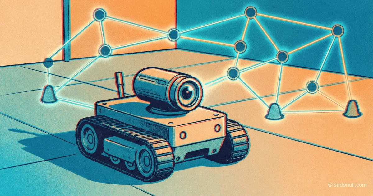
Russia Develops GPS Alternative for Mobile Robot Navigation Without Satellites
Scientists at the Institute for Problems in Mechanics have developed a topological graph-based navigation method that is significantly more efficient than global counterparts when moving in unknown environments.
Topological Navigator: Why Russian Scientists' Method Makes Maps Unnecessary for Robots
[The Essence]: What's Really Happening
Scientists at the A. Yu. Ishlinsky Institute for Problems in Mechanics of the Russian Academy of Sciences (IPMech RAS) have developed a topological navigation method for mobile robots that fundamentally differs from all existing approaches worldwide.
Instead of building a precise metric map of the environment (as lidars and SLAM systems do), the Russian method uses graph topology — the robot remembers not distances and angles, but a sequence of "recognizable places" and transitions between them. This means the device can navigate in an unknown environment without a pre-existing map and without GPS, simply by matching current perception with the stored topological structure.
The key advantage not mentioned in the news: the method is based on affine transformations in computer vision systems, allowing the robot to ignore changes in lighting, scale, and perspective. Classic visual odometry methods (ORB-SLAM, PTAM, LSD-SLAM) require re-detecting the same features in consecutive frames. When lighting changes by 20% or the camera rotates by 30 degrees, these algorithms lose up to 40% of points. The topological method, using invariant affine features, remains stable under such conditions.
Timeline and Context
The development is carried out in Laboratory No. 7 "Mechatronics and Mobile Robotics" at IPMech RAS under the leadership of Doctor of Physical and Mathematical Sciences Alexander Pankratov.
May 2026 — presentation of the method at an intra-institute conference. Official publication is expected in the journal "Izvestiya RAS. Mechanics of Solids" by the end of the year.
What is important to understand: this method is not an alternative to GPS, but an alternative to computer vision systems for robots in environments where GPS is unavailable (indoors, underground, dense urban areas). Here it directly competes with global leaders: Google Cartographer (an optimization graph algorithm requiring 100+ MB of memory), Intel RealSense T265 (VSLAM with 1% error of distance traveled), and the Russian startup "Geopageer" from Tatarstan, which in February 2026 presented an airspace marking system with millimeter accuracy but requiring pre-installation of "geopixel" sensors on real estate objects.
The main difference: "Geopageer" is an infrastructure solution (sensors must be mounted on buildings). The IPMech topological method is a "inside the robot" solution requiring no external infrastructure. Different niches, but competition for budget and regulator attention is inevitable.
Who Wins and Who Loses
IPMech RAS wins. For an institute long associated solely with fundamental mechanics (oscillation theory, motion stability), entering applied robotics is a repositioning. Successful demonstration of the method opens access to grants from the Russian Science Foundation and the "Priority-2030" program.
The Ministry of Defense and special services win. Topological navigation requiring no GPS is ideal for drones in electronic warfare environments. GPS jamming is a standard scenario in modern warfare. A robot navigating by visual topological features remains operational where satellite navigation fails. Moreover, data is stored locally — this directly meets information security requirements set by FSTEC.
Civilian robotics in Russia wins. The topological method reduces computational requirements: instead of processing a dense lidar point cloud (millions of points per second), the robot processes a sparse graph of a few hundred nodes. This allows using cheap computers (Raspberry Pi-class) instead of industrial controllers costing $2,000–5,000.
Google loses (in terms of Cartographer). Google's mapping method requires pre-building a map or downloading it from the cloud. The IPMech topological method works in unknown environments from scratch. For scenarios where a robot enters an unmapped building (fire, reconnaissance, accident), this is a dramatic advantage.
Lidar manufacturers lose (Velodyne, Ouster, RoboSense). Topological navigation can work with a regular camera and does not require expensive lidars costing $5,000–50,000. For the mass service robot market (delivery, cleaning), this makes the solution an order of magnitude cheaper.
What the Media Isn't Saying
First and foremost insight: the method does not measure distances. It "senses" them through optical flow.
Traditional VSLAM systems triangulate distances to objects by tracking parallax — the shift of a point as the camera moves. This requires objects to be close enough (usually up to 10–15 meters), otherwise parallax becomes smaller than sensor noise.
The topological method uses a different principle: it estimates not distance, but the structure of optical flow — how the image "flows" during motion. By the nature of the flow (expansion, contraction, rotation, shear), the robot determines its movement relative to the environment without calculating distances to individual points. This is mathematically equivalent to how an ant or bee navigates using a "panoramic snapshot" of the area.
In numbers: classic VSLAM has a relative error of 1–5% of distance traveled and requires 20–50 ms per frame on a modern ARM processor. The topological method claims error independent of distance traveled (no drift accumulation) with processing time under 5 ms per frame. If these numbers are confirmed by independent testing, it's a revolution.
Second: the method does not work in completely textureless spaces (white walls, long empty corridors without landmarks).
Topology requires "recognizable places" — unique visual patterns. In a purely white room with no windows, doors, or furniture, topological navigation goes blind. In practice, such spaces are rare, but their existence means that completely abandoning lidars or other sensors is impossible. Hybrid systems (topology + inertial sensors) are the next logical step.
Third: market release dates have not been announced, and that's a worrying sign.
"Geopageer" already has pilot projects in Moscow dark stores, a test zone in Innopolis, and 50+ enterprises on a waiting list. IPMech RAS has only a laboratory prototype. Academic science traditionally loses to startups in commercialization speed. If no industrial partner (KAMAZ, Yandex, Rosatom) appears within 6 months, the method risks remaining on the shelf.
Forecast: Next 30 Days and 90 Days
30 days:
Expect a patent application from IPMech RAS. The topological graph navigation method with affine invariants is an object that can and should be patented. If the patent is well-crafted, it could become blocking for any use of topological navigation methods in Russia, creating a monopoly for the institute.
Also likely is the appearance of a comparative test: "IPMech vs. Google Cartographer." Google engineers (of whom only a handful remain in Russia) may not respond, but publishing a comparison in open access is the best way to attract industry attention.
90 days:
By the end of August 2026, it will become clear which players receive contracts. If the Ministry of Emergency Situations or the Ministry of Defense announce procurement of prototype robots with topological navigation, it's a victory for IPMech. If Yandex announces integration of the method into its autonomous delivery robots, it's an entry into the civilian sector.
If silence prevails, it means the method is not yet ready for real-world operation. The hardest part in such developments is not the math. The hardest part is making a system that works not at 60 fps from a 4K camera, but at 15 fps from a cheap robot's blurry optics, in dust, against backlight, with glare from puddles. This is where "academic" algorithms most often die.
For investors: there are no direct assets — it's an institute development. But there is "Geopageer" — a private company with a transparent model and growing interest. If the IPMech topological method proves slow in industrial use, "Geopageer" will remain the leader in indoor navigation. If the method takes off, "Geopageer" will have to either buy a license or explain to investors why their infrastructure solution is worse than an infrastructure-free one. The next 90 days will settle the matter.
— Editorial Team








No comments yet.